Greensboro, Indiana facts for kids
Quick facts for kids
Greensboro, Indiana
|
|
|---|---|
| Town of Greensboro | |
 |
|

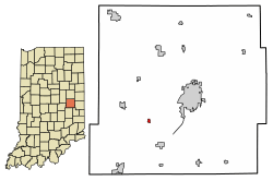
Location of Greensboro in Henry County, Indiana.
|
|
| Country | United States |
| State | Indiana |
| County | Henry |
| Township | Greensboro |
| Area | |
| • Total | 0.11 sq mi (0.29 km2) |
| • Land | 0.11 sq mi (0.29 km2) |
| • Water | 0.00 sq mi (0.00 km2) |
| Elevation | 994 ft (303 m) |
| Population
(2020)
|
|
| • Total | 123 |
| • Density | 1,118.18/sq mi (429.80/km2) |
| Time zone | UTC-5 (EST) |
| • Summer (DST) | UTC-4 (EDT) |
| ZIP code |
47344
|
| Area code(s) | 765 |
| FIPS code | 18-29682 |
| GNIS feature ID | 2396975 |
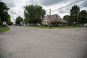
Greensboro is a small town located in Henry County, Indiana, United States. It is part of Greensboro Township. In 2020, about 123 people lived there.
Greensboro has a special place in history. It was known as a "station" on the Underground Railroad. This was a secret network that helped enslaved people find freedom. Many people in Greensboro were active abolitionists, meaning they worked to end slavery.
Contents
History of Greensboro
Greensboro was officially planned and laid out in 1830. This process is called "platting." The town got its name from Greensboro, North Carolina.
A post office has been operating in Greensboro since 1831. This shows that the town was an important community early on.
Geography of Greensboro
Greensboro is located in Indiana. According to the 2010 census, the town covers a total area of about 0.11 square miles (0.29 square kilometers). All of this area is land.
Population and People
How Many People Live Here?
The number of people living in Greensboro has changed over the years. Here's a look at the population counts from different census years:
| Historical population | |||
|---|---|---|---|
| Census | Pop. | %± | |
| 1880 | 223 | — | |
| 1890 | 318 | 42.6% | |
| 1900 | 284 | −10.7% | |
| 1910 | 250 | −12.0% | |
| 1920 | 229 | −8.4% | |
| 1930 | 239 | 4.4% | |
| 1940 | 222 | −7.1% | |
| 1950 | 241 | 8.6% | |
| 1960 | 232 | −3.7% | |
| 1970 | 225 | −3.0% | |
| 1980 | 175 | −22.2% | |
| 1990 | 204 | 16.6% | |
| 2000 | 174 | −14.7% | |
| 2010 | 143 | −17.8% | |
| 2020 | 123 | −14.0% | |
| U.S. Decennial Census | |||
A Closer Look at the People (2010 Census)
In 2010, there were 143 people living in Greensboro. These people lived in 61 different homes, and 39 of these were families.
The town had about 1,300 people per square mile. All of the people living in Greensboro at that time were identified as White. About 2.8% of the population identified as Hispanic or Latino.
About 26.2% of homes had children under 18 living there. Most homes (54.1%) were married couples living together. A small number of homes had a single parent.
The average age of people in Greensboro was 39.9 years old. About 23.1% of residents were under 18. About 16.1% were 65 years old or older. The town had slightly more males (51.7%) than females (48.3%).
See also
 In Spanish: Greensboro (Indiana) para niños
 | Jessica Watkins |
 | Robert Henry Lawrence Jr. |
 | Mae Jemison |
 | Sian Proctor |
 | Guion Bluford |

