Greenwood, Taylor County, Wisconsin facts for kids
Quick facts for kids
Greenwood, Wisconsin
|
|
|---|---|

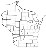
Location of Greenwood, Taylor County, Wisconsin
|
|
| Country | |
| State | |
| County | Taylor |
| Area | |
| • Total | 54.3 sq mi (140.7 km2) |
| • Land | 54.3 sq mi (140.6 km2) |
| • Water | 0.0 sq mi (0.1 km2) |
| Elevation | 1,519 ft (463 m) |
| Population
(2000)
|
|
| • Total | 642 |
| • Density | 11.8/sq mi (4.6/km2) |
| Time zone | UTC-6 (Central (CST)) |
| • Summer (DST) | UTC-5 (CDT) |
| Area code(s) | 715 & 534 |
| FIPS code | 55-31600 |
| GNIS feature ID | 1583324 |
| PLSS township | T32N R2E and southern half of T32N R3E |
Greenwood is a small town in Taylor County, Wisconsin, USA. In 2000, about 642 people lived there. A smaller community called Interwald is also part of the town.
Greenwood's Location and Land
Greenwood covers about 54 square miles (140 square kilometers). Most of this area is land, with a tiny bit of water. The Big Rib River flows through the eastern part of the town.
The land in Greenwood is mostly gently rolling hills. This shape was made by ancient glaciers, long before the last big ice age. The soil in the middle and east parts is a type called Merrill till. Along the Big Rib River, you'll find soil from melted glacier water. The western part of Greenwood has bumpy land from the last glacier. It also has sandy areas where ice-walled lakes used to be.
A Look at Greenwood's Past
The land that would become Greenwood was first measured in October 1861. A team working for the U.S. government surveyed the area. In early 1862, the same team marked all the corners of the land sections. They walked through forests and swamps to do this. They used a chain and a compass to measure.
After their work, the surveyor wrote about the western part of the area. He said the land was flat and the soil was good. He thought it was perfect for farming. He also noted that there were large trees, including high-quality white pine.
Around 1873, the Wisconsin Central Railroad built its tracks nearby. The tracks went through the forest that is now Medford, heading towards Ashland. To pay for this, the railroad was given half of the land for eighteen miles on each side of the tracks. This usually included the odd-numbered sections of land.
An old map from 1880 shows no roads in the area that would become Greenwood. There were two wagon roads touching the southwest corner. Another road, now Highway 13, was about half a mile west of Greenwood.
When Taylor County was created in 1875, Greenwood was part of a bigger area called the Town of Chelsea. In 1895, Greenwood became its own separate town.

A map from around 1900 shows that some roads and settlers were in place. By then, a road like modern County M stretched for 12 miles across the area. Another road, now Wellington Lake Road, went north and south. Other roads followed what are now Brehm Avenue, Trout Avenue, and County C. Settlers had built homes along all these roads.
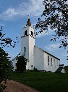
The map also showed two sawmills and four small schools. These were located on the future County M. There was also the Urquhart Post Office in the west and the Interwald Post Office in the east. Another school was where the old County C crossed the Rib River. A school and church were on Brehm Avenue, where St. Ann's church still stands today. Most of the remaining land was still owned in large blocks. The Wisconsin Central Railroad still owned many odd-numbered sections. J.J. Kennedy, who owned a sawmill in Rib Lake, was another big landowner.
The 1911 map showed even more roads and settlers. The school at County C and the Rib River had become the town hall. A Brehm Post Office appeared on the future Trout Avenue. By this time, the Wisconsin Central Railroad had sold most of its land. The remaining large land blocks were owned by different companies. These included U.S. Leather, Medford Manufacturing Co., and Wausau Lumber Co. on the east side. Two years later, a 1913 map showed the Brehm Post Office in a new spot, across from St. Ann's church.
Greenwood's Population
In 2000, the census showed that 642 people lived in Greenwood. There were 234 households and 186 families. This means there were about 11.8 people for every square mile. There were also 295 housing units.
Most of the people in Greenwood were White (98.60%). A small number were Native American, Asian, or from other backgrounds. About 0.62% of the population was Hispanic or Latino.
Out of the 234 households, 33.3% had children under 18 living there. Most households (71.4%) were married couples living together. About 2.6% were single mothers. About 17.5% of households were people living alone. And 6.8% had someone 65 or older living by themselves. The average household had 2.74 people, and the average family had 3.12 people.
The population was spread out by age. About 26.3% were under 18. About 6.5% were between 18 and 24. The largest group, 28.8%, was between 25 and 44. About 24.3% were between 45 and 64. And 14.0% were 65 or older. The average age was 38 years. For every 100 females, there were about 115.4 males.
The average income for a household in Greenwood was $34,000. For a family, it was $42,500. Men earned about $27,321 on average, while women earned about $21,528. The average income per person in the town was $14,120. About 10.2% of families and 12.7% of all people lived below the poverty line. This included 14.2% of those under 18 and 16.3% of those 65 or older.
See also
 In Spanish: Greenwood (condado de Taylor, Wisconsin) para niños
 | Ernest Everett Just |
 | Mary Jackson |
 | Emmett Chappelle |
 | Marie Maynard Daly |

