Grooverville, Georgia facts for kids
Grooverville is a small, quiet community in Brooks County, Georgia, in the United States. It's called an "unincorporated community" because it doesn't have its own local government, like a mayor or city council. Instead, it's managed by the county.
Long ago, this area was known as Key. It was an important spot where two roads met. Back then, it was part of Thomas County. Later, in 1858, Brooks County was created from parts of Lowndes and Thomas counties, and Grooverville became part of the new county.
Grooverville officially became a town on December 8, 1859. This meant it had a special document, called a charter, that gave it the power to govern itself. However, on July 1, 1995, the state of Georgia decided to end Grooverville's town status. Even though it's no longer an official town, the state of Georgia now recognizes it as a Grooverville Historic Township. This means it's a special place with a rich history.
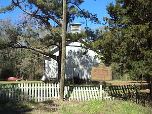
Two important churches are found in Grooverville: Grooverville Methodist Church and Liberty Baptist Church. Liberty Baptist Church is very special because it was added to the National Register of Historic Places in 2013. This list includes places across the country that are important to American history and culture.
Where is Grooverville?
Grooverville is located at 30°43′44″N 83°42′54″W / 30.72889°N 83.71500°W. This is a way to show its exact spot on a map using latitude and longitude coordinates.
The community covers a circular area. It stretches about 1.25 miles (2 kilometers) in every direction from where Liberty Church Road and Grooverville Road cross. This makes its total area about 4.9 square miles (12.7 square kilometers). Grooverville is also about 11 miles (18 kilometers) west-southwest of a larger town called Quitman.
 | Janet Taylor Pickett |
 | Synthia Saint James |
 | Howardena Pindell |
 | Faith Ringgold |


