
Brooks County, Georgia facts for kids
Quick facts for kids
Brooks County
|
||
|---|---|---|

Brooks County Courthouse in Quitman
|
||
|
||

Location within the U.S. state of Georgia
|
||
 Georgia's location within the U.S. |
||
| Country | ||
| State | ||
| Founded | December 11, 1858 | |
| Named for | Preston Brooks | |
| Seat | Quitman | |
| Largest city | Quitman | |
| Area | ||
| • Total | 498 sq mi (1,290 km2) | |
| • Land | 493 sq mi (1,280 km2) | |
| • Water | 4.8 sq mi (12 km2) 1.0%% | |
| Population
(2020)
|
||
| • Total | 16,301 | |
| • Estimate
(2023)
|
16,245 |
|
| • Density | 32.73/sq mi (12.638/km2) | |
| Time zone | UTC−5 (Eastern) | |
| • Summer (DST) | UTC−4 (EDT) | |
| Congressional district | 8th | |

Brooks County is a county in the state of Georgia, located near the border with Florida. In 2020, about 16,301 people lived here. The main town, or county seat, is Quitman. The county was created in 1858. It was named after Preston Brooks, a U.S. Representative who was very popular in the South at the time. Brooks County is part of the Valdosta metropolitan area, which is a group of nearby cities and towns that are connected.
Contents
History
Early Inhabitants and European Arrival
Long ago, Native American groups like the Apalachee and Lower Creek lived in this area. Around 1570, Spanish missionaries from their colony in Florida were the first Europeans to arrive.
How Brooks County Was Formed
The land that became Brooks County was first opened for European-American settlement in 1818. An important road called Coffee Road was built through the region in the 1820s.
In 1858, people in Lowndes County were not happy because a new railroad, the Atlantic and Gulf Railroad, planned to go around their county seat, Troupville. This led to a decision by residents to create a new county.
On December 11, 1858, Brooks County was officially formed by the state government. It was made from parts of Lowndes and Thomas counties. The county was named after Preston Brooks, a member of Congress.
The county grew with large cotton farms called plantations. These farms relied on the work of enslaved people. By 1860, Brooks County had 3,067 white residents and 3,282 enslaved people. The railroad reached Quitman, the county seat, in October 1860.
The Civil War Years
During the American Civil War, Brooks County was very important for providing food to the Confederate Army. It was even called the "Smokehouse of the Confederacy."
Some groups of soldiers for the Confederate Army were formed from men in Brooks County. However, some people, like plantation owners, were not required to join the army.
After the Civil War
After the Civil War, many formerly enslaved people became farmers, often working on land owned by others. During this time, there were many challenges and difficulties for African Americans in the county. Many African Americans later moved away from the county to find better opportunities in other parts of the country.
Modern Times
Today, Brooks County is known as part of the "Plantation Trace" tourist region.
Historical Places
- The Brooks County Courthouse was built in 1864 in Quitman. It was designed by an architect named John Wind.
- The Brooks County Museum and Cultural Center used to be a library. Now, it's a place for music, art, and food events throughout the year.
Geography
Brooks County covers about 498 square miles. Most of this area is land, with a small part being water.
The eastern side of the county is bordered by the Little River and the Withlacoochee River. These rivers wind for over 100 miles, forming the boundary with Cook and Lowndes counties. The southern border of Brooks County touches Florida for about 25 miles.
The county is home to several rare plants and animals. These include the Pond Spicebush, the Wood Stork, and the Eastern Indigo snake.
Most of Brooks County is part of the Withlacoochee River sub-basin, which flows into the Suwannee River. Some parts of the county are also in the Aucilla River sub-basin.
Neighboring Counties
- Cook County - to the northeast
- Lowndes County - to the east
- Madison County, Florida - to the southeast
- Jefferson County, Florida - to the southwest
- Thomas County - to the west
- Colquitt County - to the northwest
Towns and Communities
Cities
Unincorporated Communities
Population Information
| Historical population | |||
|---|---|---|---|
| Census | Pop. | %± | |
| 1860 | 6,356 | — | |
| 1870 | 8,342 | 31.2% | |
| 1880 | 11,727 | 40.6% | |
| 1890 | 13,979 | 19.2% | |
| 1900 | 18,606 | 33.1% | |
| 1910 | 23,832 | 28.1% | |
| 1920 | 24,538 | 3.0% | |
| 1930 | 21,330 | −13.1% | |
| 1940 | 20,497 | −3.9% | |
| 1950 | 18,169 | −11.4% | |
| 1960 | 15,292 | −15.8% | |
| 1970 | 13,739 | −10.2% | |
| 1980 | 15,255 | 11.0% | |
| 1990 | 15,398 | 0.9% | |
| 2000 | 16,450 | 6.8% | |
| 2010 | 16,243 | −1.3% | |
| 2020 | 16,301 | 0.4% | |
| 2023 (est.) | 16,245 | 0.0% | |
| U.S. Decennial Census 1790-18801890-1910 1920-1930 1930-1940 1940-1950 1960-1980 1980-2000 2010 |
|||
| Race | Number of People | Percentage |
|---|---|---|
| White | 9,066 | 55.62% |
| Black or African American | 5,684 | 34.87% |
| Native American | 24 | 0.15% |
| Asian | 67 | 0.41% |
| Pacific Islander | 6 | 0.04% |
| Other/Mixed | 499 | 3.06% |
| Hispanic or Latino | 955 | 5.86% |
In 2020, there were 16,301 people living in Brooks County. The population included people of various backgrounds.
Education
The Brooks County School District manages all the public schools in the county. It offers classes from pre-school all the way to twelfth grade. The district has two elementary schools, one middle school, and one high school, Brooks County High School. There are about 167 full-time teachers and over 2,563 students in the district.
- North Brooks Elementary School
- Quitman Elementary School
- Brooks County Middle School
- Brooks County High School
The county also has the Brooks County Public Library.
Fun Activities
Brooks County is a great place for wildlife. You can find quail, doves, ducks, and deer in the fields and forests. The county also has many lakes and streams that are open to the public for fishing.
Hospital
Brooks County Hospital is part of the Archbold Medical Center. It's a 25-bed hospital that was built in 1935 and has emergency services available 24 hours a day.
Transportation
Main Roads
 U.S. Route 84
 U.S. Route 221
 State Route 33
 State Route 38
 State Route 76
 State Route 122
 State Route 133
 State Route 333
Railroads
Georgia Bike Route 10
Georgia State Bicycle Route 10 is one of 14 bike routes in Georgia. This route is about 246 miles long and goes from Lake Seminole in the west to Jekyll Island in the east. It runs through Brooks County for about 27.3 miles and passes through downtown Quitman.
Airport
BROOKS CO (4J5) is an airport with a runway that is 5000 feet long.
Images for kids
-
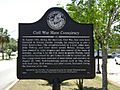
A historical marker about events during the Civil War.

See also
 In Spanish: Condado de Brooks (Georgia) para niños
