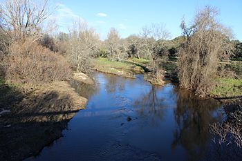
Guadyerbas facts for kids
Quick facts for kids Guadyerbas |
|
|---|---|
 |
|
| Country | Spain |
| Physical characteristics | |
| Main source | Sierra de San Vicente Navamorcuende ~1,200 m (3,900 ft) 40°8′52″N 4°44′37″W / 40.14778°N 4.74361°W |
| River mouth | Tiétar Oropesa 40°5′1″N 5°11′31″W / 40.08361°N 5.19194°W |
| Length | 45 km (28 mi) |
| Basin features | |
| River system | Tagus |
| Tagus Basin | |
The Guadyerbas is a river found in the middle of Spain. It is an important river that flows into the Tiétar River. The Tiétar River then flows into the even larger Tagus River.
Contents
About the Guadyerbas River
The Guadyerbas River is a key part of the Tagus river system. It helps carry water across the central part of the Iberian Peninsula. This river is important for the local environment and communities.
Where the River Starts and Flows
The Guadyerbas River begins in the western part of the Sierra de San Vicente mountains. It starts near a peak called Pico Cruces. The river's source is about 1,200 meters (around 3,900 feet) above sea level.
The river flows for about 45 kilometers (28 miles). It travels west through the northwest area of the province of Toledo. Finally, it joins the Tiétar River near Oropesa. This meeting point is just a few kilometers upstream from the Rosarito Reservoir.
What its Name Means
The name Guadyerbas has an interesting history. It comes from two different languages. The first part, Guad, comes from the Arabic word wadi. This word means "river" or "valley."
The second part, yerbas, comes from the Spanish word hierba. This word means "grass." So, the name Guadyerbas can be thought of as "River of Grass."
Water for People
The waters of the Guadyerbas River are held back by a dam. This dam creates the Navalcán Reservoir. Reservoirs like this are very important. They store water for people to use in homes, farms, and for other needs.
See also
 In Spanish: Río Guadyerbas para niños
 | Calvin Brent |
 | Walter T. Bailey |
 | Martha Cassell Thompson |
 | Alberta Jeannette Cassell |

