Guayabota facts for kids
Quick facts for kids
Guayabota
|
|
|---|---|
|
Barrio
|
|

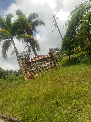
Rock wall at Guayabota barrio in Yabucoa
|
|

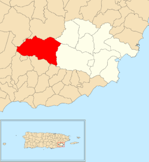
Location of Guayabota within the municipality of Yabucoa shown in red
|
|
| Lua error in Module:Location_map at line 416: Malformed coordinates value. | |
| Commonwealth | |
| Municipality | |
| Area | |
| • Total | 10.57 sq mi (27.4 km2) |
| • Land | 10.57 sq mi (27.4 km2) |
| • Water | 0 sq mi (0 km2) |
| Elevation | 1,024 ft (312 m) |
| Population
(2010)
|
|
| • Total | 3,124 |
| • Density | 295.6/sq mi (114.1/km2) |
| Source: 2010 Census | |
| Time zone | UTC−4 (AST) |
Guayabota is a special area, called a barrio, located in the town of Yabucoa, Puerto Rico. In 2010, about 3,124 people lived there. It's known for its beautiful landscapes and strong community spirit.
Contents
A Look Back at Guayabota's History
Puerto Rico became part of the United States after the Spanish–American War in 1898. This happened because of a peace agreement called the Treaty of Paris of 1898. As a result, Puerto Rico became an unincorporated territory of the United States. This means it's a part of the U.S. but doesn't have all the same rights as a state.
In 1899, the United States Department of War did a count of all the people in Puerto Rico. They found that 904 people lived in Guayabota barrio at that time. Over the years, the population grew quite a bit.
| Historical population | |||
|---|---|---|---|
| Census | Pop. | %± | |
| 1900 | 904 | — | |
| 1980 | 1,648 | — | |
| 1990 | 2,986 | 81.2% | |
| 2000 | 3,240 | 8.5% | |
| 2010 | 3,124 | −3.6% | |
| U.S. Decennial Census 1899 (shown as 1900) 1910-1930 1930-1950 1980-2000 2010 |
|||
Guayabota's Geography and Challenges
Guayabota is located in an area that can sometimes have natural challenges. For example, the land can be prone to landslides, which is when a lot of earth and rocks slide down a slope. Also, its roads and bridges have often been damaged by strong storms like hurricanes or even just very heavy rain.
Puerto Rico Highway 182 is an important road that runs through Guayabota and its different areas.
Hurricane Maria's Impact
On September 19, 2017, Hurricane Maria hit Puerto Rico very hard. This powerful storm caused a complete power outage across the entire island. It also made it difficult for people to get clean water.
The hurricane caused serious problems for many people in Yabucoa, especially older residents, making it hard for them to get help and stay safe. Nine months after the hurricane, on June 12, 2018, the mayor of Yabucoa, Rafael Surillo, shared that many parts of Yabucoa, including Guayabota, still did not have electricity.
After this experience, the people of Guayabota started working on plans. They wanted to create emergency plans and ways to make their community stronger. Their goal was to be better prepared for any future emergencies, like the ones caused by Hurricane Irma and Hurricane Maria.
Understanding Guayabota's Sectors
In Puerto Rico, barrios are like neighborhoods or districts. These barrios are then divided into even smaller local areas. These smaller areas are called sectores (which means sectors in English).
The types of sectors can be different. Some are simply called sector, while others might be known as urbanización, reparto, barriada, or residencial.
Here are some of the sectors you can find in Guayabota barrio:
- Camino Doña Zaza
- Sector El Cruce
- Sector El Veinte
- Sector La Aldea
- Sector La Coa
- Sector La Herradura
- Sector Las Panas
- Sector Los Sánchez
- Sector Quebrada Grande
- Sector Quebradillas
- Sector Surillo
- Sector Tres Puntos
See also
 In Spanish: Guayabota para niños
- List of communities in Puerto Rico
- List of barrios and sectors of Yabucoa, Puerto Rico
 | Shirley Ann Jackson |
 | Garett Morgan |
 | J. Ernest Wilkins Jr. |
 | Elijah McCoy |

