Gulkana Glacier facts for kids
Quick facts for kids Gulkana Glacier |
|
|---|---|
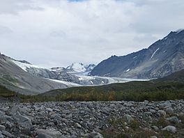
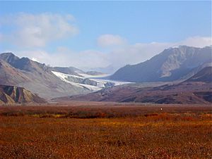
View from southwest of the glacier (August, 2013).
|
|
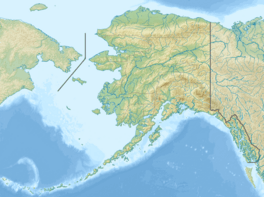
| Coordinates | 63°14′27″N 145°28′3″W / 63.24083°N 145.46750°W |
| Area | 15 square km |
| Status | retreating |
Gulkana Glacier is a giant river of ice, also known as a glacier. It flows from the icy fields on the south side of the eastern Alaska Range.
You can visit Gulkana Glacier by driving on gravel roads. These roads are off the Richardson Highway near mile post 197. This spot is close to the Richardson Monument. It's just two miles north of Summit Lake. It's also about 12 miles north of Paxson.
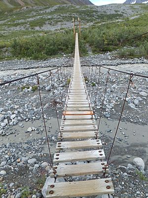
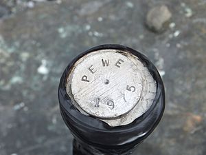
Closer to the glacier, there's a cool suspension bridge. You can walk across it over Phelan Creek. If you're lucky, you might see amazing wildlife like moose and bears! On a hill southwest of the glacier, there's a special post. It's marked PEWE 1975. Every spring, a big event called the Arctic Man competition takes place near Gulkana Glacier.
Why Scientists Study Gulkana Glacier
Gulkana Glacier is a very important place for scientists. The USGS studies it closely. They want to learn about climate change and how glaciers affect water. Gulkana Glacier is one of three main places they watch. The other two are Wolverine Glacier and South Cascade Glacier.
Scientists watch many things at Gulkana Glacier. They look at the weather and how the glacier moves. They also measure how much ice melts and how much water flows from the glacier. This helps them understand the glacier's overall health.
How Gulkana Glacier is Changing
Since 1966, the USGS has been collecting data on Gulkana Glacier. They found that the glacier is getting smaller. On average, it loses about 0.4 meters of ice thickness each year. The ice is also moving slower. This means the glacier is "retreating," or shrinking back.
The glacier is usually thickest in May or June. It can be 2 to 5 meters thicker then compared to its thinnest time in August or September.
Phelan Creek
Scientists also study Phelan Creek, which flows from the glacier. The USGS has a station there at 1,125 meters above sea level. This station is about one kilometer downstream from where the glacier ended in 1996. The creek bed is full of gravel and large rocks. This is common for a creek that flows from a moraine, which is a pile of rocks and dirt left by a glacier.
 | Janet Taylor Pickett |
 | Synthia Saint James |
 | Howardena Pindell |
 | Faith Ringgold |


