Gulpen-Wittem facts for kids
Quick facts for kids
Gulpen-Wittem
Gullepe-Wittem
|
|||
|---|---|---|---|

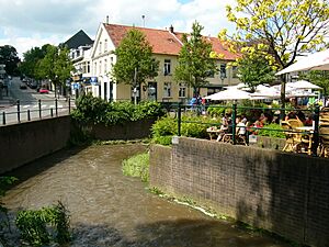
The Gulp River through Gulpen
|
|||
|
|||

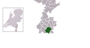
Location in Limburg
|
|||
| Country | Netherlands | ||
| Province | Limburg | ||
| Established | 1 January 1999 | ||
| Government | |||
| • Body | Municipal council | ||
| Area | |||
| • Total | 73.35 km2 (28.32 sq mi) | ||
| • Land | 73.16 km2 (28.25 sq mi) | ||
| • Water | 0.19 km2 (0.07 sq mi) | ||
| Elevation | 95 m (312 ft) | ||
| Population
(May 2014)
|
|||
| • Total | 14,431 | ||
| • Density | 197/km2 (510/sq mi) | ||
| Time zone | UTC+1 (CET) | ||
| • Summer (DST) | UTC+2 (CEST) | ||
| Postcode |
6270–6289, 6320–6321
|
||
| Area code | 043 | ||
Gulpen-Wittem is a municipality, which is like a local government area, in the southeastern part of the Netherlands. It's located in the province of Limburg. As of 2014, about 14,431 people live here.
This municipality was formed when two smaller areas, Gulpen and Wittem, joined together. Both areas asked to merge. Before the merger, each had around 8,000 residents. Wittem was a bit larger than Gulpen. The main town hall for the new municipality is in Gulpen. The old town hall of Wittem is now a special nursing home.
Gulpen-Wittem is a very rural area. You can find many old castles, unique half-timbered houses, and historic farms here. Lots of tourists visit every year, especially in summer. They come to enjoy the beautiful, hilly landscape.
Contents
Villages and Hamlets in Gulpen-Wittem
This municipality is made up of many smaller communities. These include villages and even tiny hamlets. Here are some of the places you can find in Gulpen-Wittem:
- Beertsenhoven
- Berghem
- Berghof
- Beutenaken
- Billinghuizen
- Bissen
- Bommerig
- Broek
- Cartils
- Crapoel
- Dal
- De Hut
- Diependal
- Dijk
- Elkenrade
- Elzet
- Epen
- Eperheide
- Etenaken
- Euverem
- Eys
- Eyserheide
- Gracht
- Gulpen
- Heijenrath
- Helle
- Hilleshagen
- Höfke
- Hurpesch
- Ingber
- Kapolder
- Kleeberg
- Kosberg
- Kuttingen
- Landsrade
- Mechelen
- Mingersberg
- Nijswiller
- Overeys
- Overgeul
- Partij
- Pesaken
- Piepert
- Plaat
- Reijmerstok
- Schilberg
- Schweiberg
- Sinselbeek
- Slenaken
- Stokhem
- Terlinden
- Terpoorten
- Terziet
- Trintelen
- Wahlwiller
- Waterop
- Wijlre
- Wittem
Understanding the Landscape
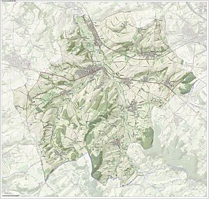
The map above shows the different features of Gulpen-Wittem. It helps you see the hills, rivers, and towns. This type of map is called a topographic map.
Economy and Local Industries
The economy in Gulpen-Wittem is quite varied. One important industry is beer brewing. You'll find the famous "Gulpener" brewery in Gulpen. Another well-known one is "Brand" in Wijlre.
Besides brewing, there's also vinegar production. Agriculture, like farming, is also very important here. But a huge part of the local economy comes from tourism. Many people visit the area, especially Slenaken, because of its beautiful scenery.
Notable People from Gulpen-Wittem
Many interesting people have come from this area. They have made contributions in different fields.
- Jan Gerard Kemmerling (1776–1818) was a mayor in nearby towns.
- Adolphe Engers (1884–1945) was a Dutch writer and actor.
- Martinus Cobbenhagen (1893–1954) was a priest, economist, and academic.
- Antoon Coolen (1897–1961) was a Dutch writer of novels.
- René van der Linden (born 1943) is a retired Dutch politician.
- Sjef Hensgens (born 1948) was a middle-distance runner who competed in the 1972 Olympics.
- Henk Savelberg (born 1953) is a famous Dutch head chef.
- Ralf Vandebergh (born 1976) is an astronomer and photographer.
Images for kids
See also
 In Spanish: Gulpen-Wittem para niños
 | Frances Mary Albrier |
 | Whitney Young |
 | Muhammad Ali |


