Gumbranch, Georgia facts for kids
Quick facts for kids
Gumbranch, Georgia
Gum Branch
|
|
|---|---|

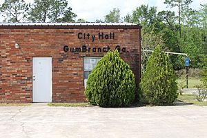
City Hall
|
|

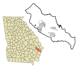
Location in Liberty County and the state of Georgia
|
|
| Country | United States |
| State | Georgia |
| County | Liberty |
| Area | |
| • Total | 0.81 sq mi (2.09 km2) |
| • Land | 0.81 sq mi (2.09 km2) |
| • Water | 0.00 sq mi (0.00 km2) |
| Elevation | 79 ft (24 m) |
| Population
(2020)
|
|
| • Total | 235 |
| • Density | 291.20/sq mi (112.41/km2) |
| Time zone | UTC-5 (Eastern (EST)) |
| • Summer (DST) | UTC-4 (EDT) |
| ZIP code |
31313
|
| Area code(s) | 912 |
| FIPS code | 13-35800 |
| GNIS feature ID | 0331886 |
Gumbranch, also known as Gum Branch, is a small city in Liberty County, Georgia, United States. It is part of the larger Hinesville-Fort Stewart area. In 2020, about 235 people lived there.
Contents
A Look Back: Gumbranch History
Gumbranch became an official city on January 1, 1979. Even though its official name is "Gumbranch," you'll often see it spelled "Gum Branch." For example, there's a nearby Gum Branch Park and Gum Branch Baptist Church.
Where is Gumbranch?
Gumbranch is located in the western part of Liberty County. You can find it at these coordinates: 31°50′20″N 81°41′4″W. Georgia State Route 196 goes through the city. This road leads about 7 miles (11 km) east to Hinesville, which is the main city of the county. It also goes about 19 miles (31 km) northwest to Glennville.
The United States Census Bureau says that Gumbranch covers a total area of about 0.81 square miles (2.1 square kilometers). All of this area is land.
People Living in Gumbranch
| Historical population | |||
|---|---|---|---|
| Census | Pop. | %± | |
| 1980 | 272 | — | |
| 1990 | 291 | 7.0% | |
| 2000 | 273 | −6.2% | |
| 2010 | 264 | −3.3% | |
| 2020 | 235 | −11.0% | |
| U.S. Decennial Census | |||
The number of people living in Gumbranch changes over time. In 2020, the population was 235.
Learning in Gumbranch
The Liberty County School District is in charge of the public schools that serve the children living in Gumbranch.
See also
 In Spanish: Gumbranch para niños
 | Chris Smalls |
 | Fred Hampton |
 | Ralph Abernathy |


