Haast River facts for kids
Quick facts for kids Haast River |
|
|---|---|

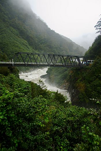
Gates of Haast Bridge in the mountains
|
|
| Country | New Zealand |
| Physical characteristics | |
| Main source | Southern Alps / Kā Tiritiri o te Moana |
| River mouth | Tasman Sea |
| Length | 100 km (62 mi) |
The Haast River / Awarua is an important river located on the West Coast of New Zealand's South Island. It is also known by its Māori name, Awarua. This river flows for about 100 kilometers (62 miles). It starts high up in the mountains and eventually flows into the Tasman Sea.
Contents
About the Haast River
The Haast River collects water from the western side of the Haast Pass. This area is like a big bowl that gathers all the rainfall and snowmelt. The river ends its journey by flowing into the Tasman Sea near the small town of Haast.
The main river that flows into the Haast River is called the Landsborough River. The land along the lower parts of the Haast River has wide, grassy areas. Local farmers use these areas to graze their cattle. If you visit, you might even see tourism companies offering exciting jetboat tours on the river.
River Environment
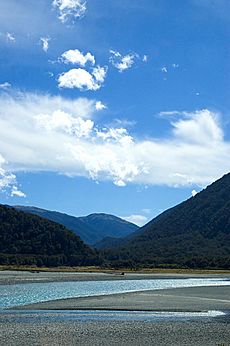
The water in the Haast River often looks cloudy. This is because it carries fine rock dust, called glacial silt. This silt comes from the glaciers high up in the Southern Alps.
Most of the land around the Haast River is owned by the public. It is managed by the Department of Conservation. This department helps protect the natural environment. The river and its surroundings are part of the Te Wahipounamu World Heritage site. This means it is a very special place recognized around the world.
State Highway 6 and Bridges
6, a main road in New Zealand, follows almost the entire length of the Haast River. Near the Haast Pass, the highway runs along the river's left side. It then crosses to the right side at a place called the Gates of Haast Bridge.
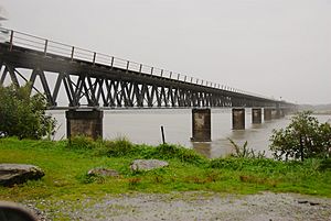
Further down, at Pleasant Flat, the valley gets wider. Here, the highway crosses back to the left side of the river. The very last bridge is close to the coast. It is just after the turnoff to the Haast township. This bridge is 737 meters (2,418 feet) long. It is the longest one-lane road bridge in New Zealand. It is also the seventh longest bridge in the country overall.
Naming the River
The Haast River was named by Julius von Haast. He was an explorer who named the river after himself. He said his boss, the Provincial Superintendent, told him to do it.
Von Haast explored a route from Otago to the West Coast in 1863. This route was already well known to Māori people. He traveled with four companions:
- William Young, who was a surveyor.
- Charles Håring, a retired sailor.
- William Francis Warner, who later owned a hotel.
- Robert Langley Holmes, who later studied weather in Canterbury.
They started their journey on January 22, 1863. They reached the coast and stood by the ocean on February 20. The Māori name for the river is Awarua.
See also
 In Spanish: Río Haast para niños
 | Tommie Smith |
 | Simone Manuel |
 | Shani Davis |
 | Simone Biles |
 | Alice Coachman |


