Hachita Valley facts for kids
Quick facts for kids Hachita Valley |
|
|---|---|

|
|
| Length | 35 mi (56 km) |
| Width | 7 mi (11 km) |
| Geography | |
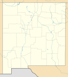
| Location | United States, New Mexico, Hidalgo & Grant |
| Borders on | Howell's Ridge-NNW Little Hatchet Mountains-W & NW Big Hatchet Mountains-SW Apache Hills-E & SE Chihuahua state, Mexico-SSE |
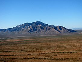
The Hachita Valley is a small valley in the southwest part of New Mexico. Its name comes from the Spanish language word hachita, which means "little hatchet" or "little axe".
This valley is located in the eastern part of the New Mexico Bootheel region. It shares a border with the state of Chihuahua in Mexico. The town of Hachita, New Mexico is in the valley's northeast. Here, New Mexico State Road 9 runs from east to west across southern New Mexico. To the west of Hachita Valley, beyond some mountain ranges, lies the large Playas Valley.
Hachita Valley is part of the northwest Chihuahuan Desert. The southeastern part of the valley drains into the desert areas of northern Chihuahua. The valley is shaped by three mountain ranges around it. The northern part of the valley has a gentle slope called a bajada, which leads up to higher mountains and the Continental Divide of the Americas.
Most of the valley is in Hidalgo County. However, the very northern tip, north of Hachita, is in southern Grant County.
About Hachita Valley
The Hachita Valley runs mostly north to south for about 20 miles in its northern section. Then, it suddenly turns southeast for 15 miles, opening up into the lower desert areas of northern Chihuahua. The Apache Hills are a large group of hills to the east and northeast. These hills cause the valley to curve.
A main dry riverbed, called a wash, runs through the southeastern part of the valley. The northern part does not have a main wash. Instead, water drains towards a central bajada. A bajada is a wide, gently sloping area of land formed by many small streams. This northern bajada stretches past Hachita, New Mexico, on the east and Old Hachita, New Mexico, on the west.
The valley turns southeast because of the Big Hatchet Mountains to its southwest. These mountains also run southeast. At this point, the valley becomes narrower, between 5 and 7 miles wide, with the Apache Hills to the northeast. In the northwest, where the valley is wider, the Little Hatchet Mountains are on the western side. The old town of Old Hachita is to the northeast of the Little Burro Mountains. The town of Playas is to the northwest.
Twelvemile Wells is located near the center of the valley. It is just north of where the valley starts its turn to the southeast, close to the beginning of the southeastern washes. In the northeast part of the Big Hatchet Mountains, next to the southwest side of the valley, is the Big Hatchet Mountains Wilderness Study Area. This is a special area protected for its natural beauty.
How to Get There
New Mexico State Road 81 crosses the northern part of the valley. It starts near Hachita and goes southwest towards the Playas Valley. It passes through a narrow passage called Hachita Gap, which is between the Little Hatchet Mountains and the Big Hatchet Mountains.
See also
 In Spanish: Valle de Hachita para niños
 | Leon Lynch |
 | Milton P. Webster |
 | Ferdinand Smith |


