
Big Hatchet Mountains facts for kids
Quick facts for kids Big Hatchet Mountains |
|
|---|---|

Big Hatchet Peak at extreme northwest end of range
|
|
| Highest point | |
| Peak | Big Hatchet Peak-(northwest perimeter of range) (Big Hatchet Mountains) |
| Elevation | 8,356 ft (2,547 m) |
| Dimensions | |
| Length | 18 mi (29 km) NW-SE |
| Width | 8 mi (13 km) |
| Geography | |

Location in New Mexico
|
|
| Country | United States |
| State | New Mexico |
| Region | New Mexico Bootheel ((northwest)-Chihuahuan Desert) Continental Divide of the Americas |
| District | Hidalgo County NM |
| Settlement | Hachita, NM |
| Range coordinates | 31°35′50″N 108°20′14″W / 31.59722°N 108.33722°W |
| Borders on | Little Hatchet Mountains-NNW Hatchita Valley-N & NE Playas Valley-NW, W & SW Alamo Hueco Mountains-S |
The Big Hatchet Mountains are a mountain range in Hidalgo County, New Mexico. This range is about 18 miles (29 km) long. It sits close to the border with Chihuahua, Mexico.
These mountains are just south of the Continental Divide of the Americas. This is a special line where water flows either to the Atlantic or Pacific Ocean. The Big Hatchet Mountains are on the eastern edge of the Playas Valley. They are also part of the Chihuahuan Desert, a large desert area.
Contents
Exploring the Big Hatchet Mountains
The Big Hatchet Mountains stretch for about 18 miles (29 km). They are about 8 miles (13 km) wide. The range runs from northwest to southeast. Nearby, the Alamo Hueco Mountains also run in a similar direction. The Little Hatchet Mountains, to the northwest, also follow this general path.
How the Mountains Were Formed
The Big Hatchet Mountains are part of the Basin and Range Province. This is a huge area in the southwestern U.S. and Mexico. It has many mountains and valleys. These mountains were formed by large cracks, or faults, in the Earth's crust. They are made of old rocks like limestone from the Paleozoic Era. They also have younger rocks like shale and sandstone from the Cretaceous period.
Animals and Plants of the Mountains
Even though the Big Hatchet Mountains are near the Chihuahuan Desert, they are tall enough to have different kinds of environments. This means many types of animals can live here. You might find bats flying at night. There are also many raptors, like hawks and eagles. Other cool animals include bighorn sheep and javelina, which are wild pig-like animals.
Visiting the Big Hatchet Mountains
The Big Hatchet Mountains are far from big cities. There are no paved roads or special places for visitors. This means not many people come here for fun. However, some long-distance hikers visit. They might be starting or finishing the Continental Divide Trail. This trail goes all the way from Canada to Mexico. The main path to the highest peak is fairly easy to follow.
Highest Points in the Range
The tallest spot in these mountains is Big Hatchet Peak. It stands at 8,366 feet (2,550 meters) high. This peak is located at the northwest end of the range. Another high point is New Well Peak. It is at the southeast end of the range and is 6,284 feet (1,915 meters) tall.
The Continental Divide Trail
The Continental Divide of the Americas is a very important line. It runs north of the Big Hatchet Mountains. This line separates which way water flows across the continent. The Continental Divide National Scenic Trail (CDT) is a famous hiking trail. It passes through the Big Hatchet Mountains in a couple of ways. One path goes through the center, and another is in the north. There are also smaller trails that lead off to the southeast. The main part of the CDT leaves the mountains to meet the Alamo Hueco Mountains.
-
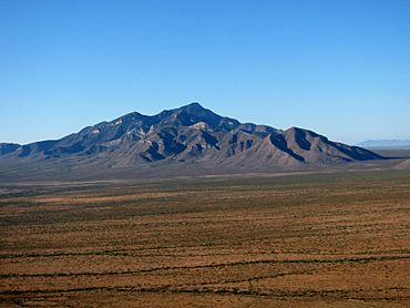
Big Hatchet Mountains from the northeast
-
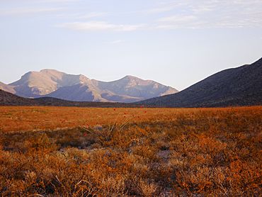
Sunrise on the Hatchet Mountains viewed from the southeast, on the CDT
-
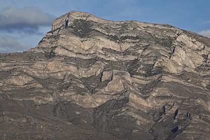
Example of the complex geology in the range from the Big Hatchet Mountains Wilderness Study Area


.jpg)
