Hallam, Nebraska facts for kids
Quick facts for kids
Hallam, Nebraska
|
|
|---|---|
|
Village
|
|

Main Street, Hallam
|
|

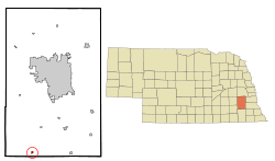
Location of Hallam, Nebraska
|
|
| Country | United States |
| State | Nebraska |
| County | Lancaster |
| Area | |
| • Total | 0.21 sq mi (0.56 km2) |
| • Land | 0.21 sq mi (0.56 km2) |
| • Water | 0.00 sq mi (0.00 km2) |
| Elevation | 1,486 ft (453 m) |
| Population
(2020)
|
|
| • Total | 268 |
| • Density | 1,246.51/sq mi (480.92/km2) |
| Time zone | UTC-6 (Central (CST)) |
| • Summer (DST) | UTC-5 (CDT) |
| ZIP code |
68368
|
| Area code(s) | 402 |
| FIPS code | 31-20610 |
| GNIS feature ID | 2398224 |
Hallam is a small village located in Lancaster County, Nebraska, in the United States. It is part of the larger Lincoln metropolitan area. In 2020, about 268 people lived there.
Contents
History of Hallam
Hallam was officially planned and marked out in 1892. This happened when the Chicago, Rock Island and Pacific Railroad extended its railway line to that spot. A man named Frederick Schneider sold the land for the new village.
How Hallam Got Its Name
Frederick Schneider was asked to name the new village. However, all his ideas were already names of other towns in Nebraska. So, the honor of naming the settlement went to Jacob Schadd. He was the first person to own land in the village.
Schadd suggested the name "Hallau," after his hometown in Switzerland. But, there was a mistake when the name was written down at the post office. It was recorded as "Hallam" instead of "Hallau." This is how the village got its unique name.
Early Days in Hallam
In the late 1800s, it was unusual for women to own much land. However, Mrs. Maggie Classen owned several lots in Hallam. A telephone office and a doctor's office were built on her land.
By the early 1900s, Hallam was a busy place. It had a bank, a hardware store, and a dry goods store. There was also a shoe shop, a druggist (a type of pharmacy), and a livery barn for horses. A doctor also practiced in the village.
Nuclear Power Plant
In 1962, the second nuclear power plant in the United States was finished in Hallam. This plant produced nuclear power for about one year. After that, it was changed to run on coal power instead.
The 2004 Hallam Tornado
On May 22, 2004, a very strong tornado hit Hallam. This tornado was rated an F4 on the Fujita scale. It sadly killed one person and injured almost 40 others. Most of the town was destroyed by the storm.
The tornado's path was about 2.5 miles (4.0 km) wide. At the time, this made it the widest tornado ever recorded. However, this record was later broken on May 31, 2013. The El Reno tornado in Oklahoma was 2.6 miles (4.2 km) wide.
Geography of Hallam
Hallam is a small village with a total area of about 0.17 square miles (0.44 square kilometers). All of this area is land, with no water.
Population and People
| Historical population | |||
|---|---|---|---|
| Census | Pop. | %± | |
| 1910 | 168 | — | |
| 1920 | 212 | 26.2% | |
| 1930 | 193 | −9.0% | |
| 1940 | 168 | −13.0% | |
| 1950 | 172 | 2.4% | |
| 1960 | 264 | 53.5% | |
| 1970 | 280 | 6.1% | |
| 1980 | 290 | 3.6% | |
| 1990 | 309 | 6.6% | |
| 2000 | 276 | −10.7% | |
| 2010 | 213 | −22.8% | |
| 2020 | 268 | 25.8% | |
| U.S. Decennial Census | |||
The population of Hallam has changed over the years. In 1910, there were 168 people. The population grew to 309 by 1990. After the 2004 tornado, the population dropped to 213 in 2010. By 2020, it had increased again to 268 people.
2010 Census Information
According to the census from 2010, there were 213 people living in Hallam. These people lived in 78 households, and 63 of these were families. The village had about 1253 people per square mile (484 people per square kilometer).
Most of the people in Hallam were White (95.3%). A small number were Native American (0.9%) or Asian (3.3%). About 0.5% of residents were from two or more races.
The average age of people in Hallam was 35.1 years old. About 27.7% of residents were under 18 years old. About 7% of residents were 65 years old or older. The village had slightly more males (53.5%) than females (46.5%).
See also
 In Spanish: Hallam (Nebraska) para niños
 | James Van Der Zee |
 | Alma Thomas |
 | Ellis Wilson |
 | Margaret Taylor-Burroughs |

