Hanks, North Dakota facts for kids
Quick facts for kids
Hanks
|
|
|---|---|

Hanks, North Dakota
|
|
| Country | United States |
| State | North Dakota |
| County | Williams |
| Elevation | 2,116 ft (645 m) |
| Time zone | UTC-6 (Central (CST)) |
| • Summer (DST) | UTC-5 (CDT) |
| Area code(s) | 701 |
| GNIS feature ID | 1029297 |
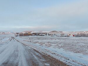
Hanks is a small place in Williams County, North Dakota, United States. It is an unincorporated community, which means it doesn't have its own local government like a city or town.
About Hanks
Where is Hanks?
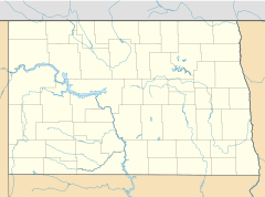
Hanks is found along North Dakota Highway 50. It is located in the western part of North Dakota. The area is about 2,116 feet (645 meters) above sea level. This means it's pretty high up! Hanks is in the Central Time Zone, just like many other places in the middle of the United States.
A Look Back in Time
Hanks started in 1916. It was built along a Great Northern Railway train line. This line connected the towns of Stanley and Grenora. The community was named after W.F. Hanks, who was a banker from Powers Lake.
In 1992, Hanks stopped being an official town. This is called "disincorporating." A report from 2008 said that only one person lived there. Hanks was even featured in a National Geographic magazine article called The Emptied Prairie in January 2008.
Population Changes
Over the years, the number of people living in Hanks has changed a lot. Here's a quick look at its population:
| Historical population | |||
|---|---|---|---|
| Census | Pop. | %± | |
| 1930 | 213 | — | |
| 1940 | 192 | −9.9% | |
| 1950 | 115 | −40.1% | |
| 1960 | 78 | −32.2% | |
| 1970 | 13 | −83.3% | |
| 1980 | 10 | −23.1% | |
| 1990 | 11 | 10.0% | |
| U.S. Decennial Census | |||
As you can see, the population was highest in 1930 with 213 people. After that, it slowly became smaller over many decades.
Famous Faces
One notable person from Hanks is A. R. Shaw. He was an educator, meaning he worked in schools. He also served as a legislator, which means he was a person elected to make laws for the state.
 | Delilah Pierce |
 | Gordon Parks |
 | Augusta Savage |
 | Charles Ethan Porter |


