Hanna, Indiana facts for kids
Quick facts for kids
Hanna, Indiana
|
|
|---|---|

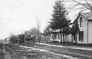
Hanna, 1910
|
|

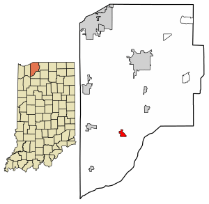
Location in LaPorte County, Indiana
|
|
| Country | United States |
| State | Indiana |
| County | LaPorte |
| Township | Hanna |
| Platted | 1858 |
| Area | |
| • Total | 0.98 sq mi (2.53 km2) |
| • Land | 0.98 sq mi (2.53 km2) |
| • Water | 0.00 sq mi (0.00 km2) |
| Elevation | 709 ft (216 m) |
| Population
(2020)
|
|
| • Total | 450 |
| • Density | 460.12/sq mi (177.64/km2) |
| Time zone | UTC-5 (Eastern) |
| • Summer (DST) | UTC-4 (EDT) |
| ZIP code |
46340
|
| FIPS code | 18-31180 |
| GNIS feature ID | 2629779 |
Hanna is a small community located in LaPorte County, Indiana, in the United States. It is known as a census-designated place, which means it's a special area identified by the government for gathering information about its population. In 2020, about 450 people lived there.
Contents
A Look Back: Hanna's History
Hanna was officially started in the year 1858. It was named after a judge from Indiana whose last name was Hanna. This judge was an important person in the state's early history.
Where is Hanna? (Geography)
Hanna is found in the southern part of LaPorte County. It is located in the western area of Hanna Township. A major road, U.S. Route 30, also known as the Lincoln Highway, goes right through the northern side of the community. This road can take you about 16 miles (26 km) west to Valparaiso or about 25 miles (40 km) east to Plymouth.
The total area of Hanna is about 0.98 square miles (2.53 square kilometers). All of this area is land, with no water bodies like lakes or rivers within its boundaries.
Who Lives in Hanna? (Population)
The number of people living in Hanna changes over time. In 2010, there were 463 people. By 2020, the population was 450. This information comes from the United States Census Bureau, which counts people every ten years.
| Historical population | |||
|---|---|---|---|
| Census | Pop. | %± | |
| 2010 | 463 | — | |
| 2020 | 450 | −2.8% | |
| U.S. Decennial Census | |||
Fun and Learning in Hanna
Hanna has a local branch of the La Porte County Public Library. This library offers books, resources, and programs for everyone in the community. It is a great place for learning and discovering new things.
See also
 In Spanish: Hanna (Indiana) para niños
 | Kyle Baker |
 | Joseph Yoakum |
 | Laura Wheeler Waring |
 | Henry Ossawa Tanner |


