Haralambiev Island facts for kids

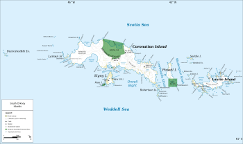
Map of the South Orkney Islands
|
|
|
Location of Haralambiev Island
|
|
| Geography | |
|---|---|
| Location | Antarctica |
| Coordinates | 60°35′44″S 46°04′38″W / 60.59556°S 46.07722°W |
| Archipelago | South Orkney Islands |
| Area | 13 ha (32 acres) |
| Length | 530 m (1,740 ft) |
| Width | 300 m (1,000 ft) |
| Administration | |
|
Administered under the Antarctic Treaty System
|
|
| Demographics | |
| Population | uninhabited |
Haralambiev Island (which is also called Haralambiev ostrov in Bulgarian) is a small, rocky island located in Antarctica. It is part of the Larsen Islands group, which lies on the west side of Coronation Island. This island is one of the many islands in the South Orkney Islands.
The island is about 530 meters (1,740 feet) long and 300 meters (980 feet) wide. Its total area is around 13 hectares (32 acres). No one lives on Haralambiev Island.
The island is named after Captain Hristo Haralambiev (1948–2005). He was the commander of a Bulgarian fishing ship called Aktinia. Captain Haralambiev sailed to Antarctic waters to fish between 1979 and 1980. Bulgarian fishermen, along with those from the Soviet Union, Poland, and East Germany, were among the first to start modern fishing in the Antarctic.
Where is Haralambiev Island?
Haralambiev Island is located at 60°35′44″S 46°04′38″W / 60.59556°S 46.07722°W. It is found about 2.8 kilometers (1.7 miles) northwest of Moreton Point. It is also very close to other islands:
- It is only 160 meters (520 feet) northwest of Monroe Island.
- It is 200 meters (660 feet) southeast of Angelov Island.
British explorers mapped this area in 1963.


