Angelov Island facts for kids

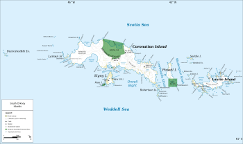
Map of the South Orkney Islands
|
|
|
Location of Angelov Island
|
|
| Geography | |
|---|---|
| Location | Antarctica |
| Coordinates | 60°35′35″S 46°05′22″W / 60.59306°S 46.08944°W |
| Archipelago | South Orkney Islands |
| Area | 17 ha (42 acres) |
| Length | 700 m (2,300 ft) |
| Width | 530 m (1,740 ft) |
| Administration | |
|
Administered under the Antarctic Treaty System
|
|
| Demographics | |
| Population | Uninhabited |
Angelov Island (Bulgarian: Ангелов остров, romanized: Angelov ostrov) is a small, rocky island located in the cold waters of Antarctica. It's part of a group called the Larsen Islands, which are found on the west side of Coronation Island in the South Orkney Islands. This island is about 700 meters long and 530 meters wide. It covers an area of about 17 hectares, which is roughly the size of 17 international rugby fields.
The island is named after Captain Kosyo Angelov. He was a Bulgarian sea captain who lived from 1948 to 2005. Captain Angelov commanded a large fishing ship called the Argonavt. His ship was part of the Bulgarian company Ocean Fisheries – Burgas. From December 1978 to July 1979, Captain Angelov and his crew went on a fishing trip to Antarctic waters. They explored areas near South Georgia and the South Orkney Islands.
Besides fishing, the Argonavt also carried a team of scientists. These scientists studied the fish and marine life in the Antarctic. Bulgarian fishermen, along with those from the Soviet Union, Poland, and East Germany, were among the first to develop modern fishing in Antarctica.
Where is Angelov Island?
Angelov Island is located at 60°35′35″S 46°05′22″W / 60.59306°S 46.08944°W. This means it's in the southern part of the world, close to the South Pole.
- It is about 3.53 kilometers northwest of Moreton Point.
- It is 700 meters northwest of Monroe Island.
- It is 200 meters northwest of Haralambiev Island.
- It is 150 meters southeast of Nicolas Rocks.
British explorers mapped this area in 1963.


