Harcuvar Mountains facts for kids
Quick facts for kids Harcuvar Mountains |
|
|---|---|
| Highest point | |
| Peak | Smith Peak (Arizona) |
| Elevation | 5,242 ft (1,598 m) |
| Dimensions | |
| Length | 25 mi (40 km) SW-NE |
| Width | 5 mi (8.0 km) |
| Geography | |
| Country | United States |
| Settlement | Wenden, Arizona–Salome, Arizona-(SW) Vicksburg, Harcuvar & Aguila, AZ-(SW & SE) |
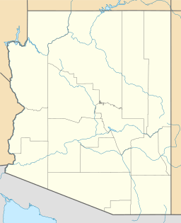
The Harcuvar Mountains (called Ahakuwa by the Yavapai people) are a long, narrow group of mountains in western-central Arizona, United States. They are located east of the Colorado River and south of the Bill Williams River, near Alamo Lake State Park.
These mountains are part of a larger area called the Maria fold and thrust belt. This region, found in western-central Arizona and parts of southern California, has many mountains, valleys, and flat areas. The Colorado River flows south through the western part of this belt.
The Harcuvar Mountains are about 25 miles (40 km) long and 5 miles (8 km) wide. They stretch from the southwest to the northeast. The McMullen Valley is located along the southeast side of the mountains. U.S. Route 60 runs through this valley.
Contents
Tallest Peaks in the Harcuvar Mountains
There are four main peaks in the Harcuvar Mountains. The highest point is Smith Peak (Arizona), which is 5,242 feet (1,600 meters) tall. It is located in the northeast part of the range but is hard to reach by road.
In the southwest, you'll find Harcuvar Peak, which is 4,618 feet (1,408 meters) high. You can get to this peak using a dirt road through Cottonwood Pass. Two other peaks are in the middle of the mountains. One is called ECC Peak, at 3,000 feet (914 meters), located north of Cunningham Pass. Further northeast is ECP Peak, which is 4,593 feet (1,400 meters) tall.
Harcuvar Mountains Wilderness Area
In 1990, a special area within the Harcuvar Mountains became part of the National Wilderness Preservation System. This system protects wild places across the country. The Harcuvar Mountains Wilderness is in northeast La Paz County, about 82 miles (132 km) northwest of Phoenix, Arizona. This area is kept wild and untouched for nature and future generations.
Getting to the Harcuvar Mountains
The Harcuvar Mountains are an important gateway to Alamo Lake State Park. This park is about 30 miles (48 km) up the Bill Williams River. The main road to the lake from the south starts in Wenden, Arizona. It quickly goes up through the Harcuvar Mountains, passing through Cunningham Pass. After that, the road continues for another 24 miles (39 km) through the Butler Valley and flat areas near the Buckskin Mountains.
The entire southeast side of the Harcuvar Mountains borders the McMullen Valley. U.S. Route 80 runs along this border. Several towns are located along this route, starting from the southwest: Vicksburg, Hope, and Harcuvar. Then come Salome and Wenden. Finally, after a 26-mile (42 km) straight road, you reach Aguila. From Aguila, you can connect to U.S. Route 93, which leads to Kingman or Phoenix.
Major Mountain Ranges in the Region
The Harcuvar Mountains are part of a group of large mountain ranges in the Maria fold and thrust belt region. These ranges run from the southeast to the northwest. They include:
- Buckskin Mountains
- Harcuvar Mountains
- McMullen Valley
- Harquahala Mountains
This region also has many other plains, valleys, and smaller mountain areas. For example, Alamo Lake State Park is to the northeast of the Buckskin Mountains. The Bill Williams River forms the northern border of these three main ranges. This river also separates the Mojave Desert to the north from the Sonoran Desert to the south.
 | James B. Knighten |
 | Azellia White |
 | Willa Brown |


