
Hato Tejas, Bayamón, Puerto Rico facts for kids
Quick facts for kids
Hato Tejas
|
|
|---|---|
|
Barrio
|
|

Looking north from Hato Tejas
|
|

Location of Hato Tejas within the municipality of Bayamón shown in red
|
|
| Lua error in Module:Location_map at line 416: Malformed coordinates value. | |
| Commonwealth | |
| Municipality | |
| Area | |
| • Total | 5.46 sq mi (14.1 km2) |
| • Land | 5.46 sq mi (14.1 km2) |
| • Water | 0.00 sq mi (0 km2) |
| Elevation | 226 ft (69 m) |
| Population
(2010)
|
|
| • Total | 41,851 |
| • Density | 3,211.7/sq mi (1,240.0/km2) |
| Source: 2010 Census | |
| Time zone | UTC−4 (AST) |
Hato Tejas is a special area called a barrio in the city of Bayamón, Puerto Rico. Think of a barrio like a neighborhood or a district within a bigger town. In 2010, about 41,851 people lived here. It's a busy and important part of Bayamón!
History of Hato Tejas
Puerto Rico has a long and interesting history. After the Spanish–American War, which was a conflict between Spain and the United States, Puerto Rico was given to the U.S. by Spain. This happened under the rules of the Treaty of Paris of 1898, which was the peace agreement that ended the war.
Because of this treaty, Puerto Rico became an unincorporated territory of the United States. This means it's a place that belongs to the U.S. but isn't a state.
Early Population Count
In 1899, the United States Department of War did a census in Puerto Rico. A census is like a big count of all the people living in an area. This count showed that only 1,358 people lived in the Hato Tejas barrio at that time.
Over the years, the population of Hato Tejas grew a lot! You can see how much it changed in the table below:
| Historical population | |||
|---|---|---|---|
| Census | Pop. | %± | |
| 1900 | 1,358 | — | |
| 1950 | 6,514 | — | |
| 1980 | 44,079 | — | |
| 1990 | 47,051 | 6.7% | |
| 2000 | 46,528 | −1.1% | |
| 2010 | 41,851 | −10.1% | |
| U.S. Decennial Census 1899 (shown as 1900) 1910-1930 1930-1950 1980-2000 2010 |
|||
Gallery
Here are some pictures showing different parts of Hato Tejas:
-
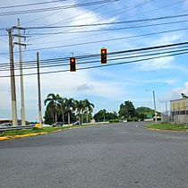
PR-29 in Hato Tejas
-
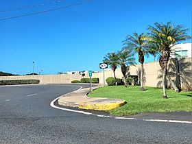
PR-871 in Hato Tejas
-
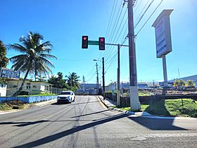
PR-872 in Hato Tejas


.jpg)
See also
 In Spanish: Hato Tejas para niños
- List of communities in Puerto Rico
