
Hato Viejo, Ciales, Puerto Rico facts for kids
Quick facts for kids
Hato Viejo
|
|
|---|---|
|
Barrio
|
|
.jpg)
Historic Manatí Bridge at Mata de Plátano
|
|

Location of Hato Viejo within the municipality of Ciales shown in red
|
|
| Lua error in Module:Location_map at line 416: Malformed coordinates value. | |
| Commonwealth | |
| Municipality | |
| Area | |
| • Total | 13.23 sq mi (34.3 km2) |
| • Land | 13.17 sq mi (34.1 km2) |
| • Water | 0.06 sq mi (0.2 km2) |
| Elevation | 715 ft (218 m) |
| Population
(2010)
|
|
| • Total | 2,442 |
| • Density | 185.4/sq mi (71.6/km2) |
| Source: 2010 Census | |
| Time zone | UTC−4 (AST) |
Hato Viejo is a special area, called a barrio, located in the town of Ciales, Puerto Rico. In 2010, about 2,442 people lived there. Hato Viejo is known for having many smaller areas called sectors, a very old bridge, and a cool local story about a boy and a cave.
Contents
History of Hato Viejo
After the Spanish–American War, Spain gave Puerto Rico to the United States in 1898. This happened because of a peace agreement called the Treaty of Paris of 1898. Puerto Rico then became a territory of the U.S.
In 1899, the U.S. government counted everyone living in Puerto Rico. They found that 1,800 people lived in Hato Viejo barrio at that time.
Years later, in August 2020, the U.S. government's Federal Emergency Management Agency (FEMA) provided money to help the coffee farms in Puerto Rico. This money directly helped a coffee processing plant in Hato Viejo. The coffee industry had lost millions of dollars when Hurricane Maria hit Puerto Rico on September 20, 2017.
| Historical population | |||
|---|---|---|---|
| Census | Pop. | %± | |
| 1900 | 1,800 | — | |
| 1910 | 2,077 | 15.4% | |
| 1920 | 1,883 | −9.3% | |
| 1930 | 2,719 | 44.4% | |
| 1940 | 2,930 | 7.8% | |
| 1950 | 1,951 | −33.4% | |
| 1980 | 1,518 | — | |
| 1990 | 2,232 | 47.0% | |
| 2000 | 2,444 | 9.5% | |
| 2010 | 2,442 | −0.1% | |
| U.S. Decennial Census 1899 (shown as 1900) 1910-1930 1930-1950 1980-2000 2010 |
|||
Cool Places in Hato Viejo
One of the most interesting spots in Hato Viejo is the Manatí Bridge at Mata de Plátano. This bridge was built way back in 1905. It's a popular place for visitors and connects Ciales to a nearby town called Manatí.
Sectors of Hato Viejo
In Puerto Rico, barrios are like big neighborhoods. These barrios are then divided into even smaller areas called sectores (which means sectors in English). These sectors can have different names, like urbanización or barriada, depending on how they are built.
Here are some of the sectors you can find in Hato Viejo barrio:
- Sector Caliche
- Sector Campamento
- Sector Cuchillas
- Sector Cumbre
- Sector El Cuco
- Sector La Grama
- Sector Las Lajas
- Sector Las Lomas
- Sector Los Arnao
- Sector Los Barberos
- Sector Los Rosa
- Sector Los Otero
- Urbanización Alturas de Ciales
- Urbanización Monterrey
Folklore and Legends
Hato Viejo has a famous local legend called El niño de Caliche, which means "The Boy of Caliche." This story is about a young boy from the Caliche Sector.
The legend says that a mother was working hard picking fruit. Her son was with her, but he kept running around and playing. To keep him safe and still, she asked him to stay in a cave while she worked. But every time she took him to the cave, he would follow her back to where she was working.
In her last try to get him to wait in the cave, she sang him a song as she slowly walked away. Part of the song goes, "...Ay, turulete, Ay turulete, que el que no tiene vaca no bebe leche.." This means, "Oh, turulete, oh turulete, he who has no cow, drinks no milk..."
Sadly, the mother never came back for her son. Night fell, and the boy started to cry. Locals say that even today, you can sometimes hear a boy crying near the cave. They also say they see him playing around, but when they try to get closer, he disappears, only to show up again a few steps away.
Gallery
-
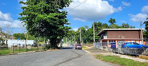
Puerto Rico Highway 6633 in Hato Viejo

See also
 In Spanish: Hato Viejo (Ciales) para niños
- List of communities in Puerto Rico
- List of barrios and sectors of Ciales, Puerto Rico
