
Heflin, Alabama facts for kids
Quick facts for kids
Heflin
|
||
|---|---|---|
|
City
|
||

Heflin, Alabama
|
||
|
||
| Motto(s):
"A Great Place to Call Home."
|
||

Location of Heflin in Cleburne County, Alabama.
|
||
| Country | United States | |
| State | Alabama | |
| County | Cleburne | |
| Incorporated | 1886 | |
| Government | ||
| • Type | City Council/Mayor | |
| Area | ||
| • Total | 16.31 sq mi (42.23 km2) | |
| • Land | 16.13 sq mi (41.77 km2) | |
| • Water | 0.18 sq mi (0.46 km2) | |
| Elevation | 961 ft (293 m) | |
| Population
(2020)
|
||
| • Total | 3,431 | |
| • Density | 212.74/sq mi (82.14/km2) | |
| Time zone | UTC−6 (Central (CST)) | |
| • Summer (DST) | UTC−5 (CDT) | |
| ZIP code |
36264
|
|
| Area code(s) | 256 | |
| FIPS code | 01-33976 | |
| GNIS feature ID | 0159746 | |
| Website | http://www.cityofheflin.org/ | |
Heflin is a city in Alabama, United States. It's the main town, or "county seat," of Cleburne County. In 2020, about 3,431 people lived there. Heflin is easy to find because it's located right between two big cities, Birmingham and Atlanta, along Interstate 20.
Contents
History of Heflin

Heflin started as a small settlement in 1882. It was a stop along a new railroad line coming from Atlanta. The town quickly grew bigger. It officially became a city in 1886.
For a while, the main government office (county seat) for Cleburne County was in a town called Edwardsville. But in 1905, people voted to move the county seat to Heflin. Heflin won the election! The Alabama Supreme Court agreed with the decision on July 1, 1906.
Geography of Heflin
Heflin is located in the eastern part of Alabama. It's about 15 miles (24 km) west of the border with Georgia. The city covers about 16.31 square miles (42.23 square kilometers). Most of this area is land, with a small part being water.
Interstate 20 is a major highway that runs through the southern part of Heflin. This highway makes it easy to travel to other cities. For example, Birmingham is about 76 miles (122 km) to the west. Atlanta is about 72 miles (116 km) to the east. Other important roads like U.S. Route 78 and two state routes also pass through the city.
Climate
Heflin has a humid subtropical climate. This means it has hot, humid summers and mild winters. The city gets a good amount of rain throughout the year.
Population and People
Heflin has grown steadily over the years. In 1890, only 383 people lived there. By 2020, the population had grown to 3,431 people.
Who Lives in Heflin?
According to the 2020 census, most people in Heflin are White (about 85.4%). About 8.8% of the people are Black or African American. There are also smaller groups of Native American, Asian, and Pacific Islander residents. About 4.3% of people are from other races or a mix of races. About 1% of the population is Hispanic or Latino.
In 2020, there were 1,340 households in Heflin. A household is a group of people living together in one home. There were also 677 families living in the city.
Fun Things to Do
Heflin is home to the Hollis Speedway. This is a place where people can go to watch exciting car races.
Schools in Heflin
The Cleburne County Board of Education provides public education in Heflin. Students in Heflin attend several schools, including:
- Cleburne County High School (for grades 8 to 12)
- Cleburne County Career Technical School (for grades 9 to 12, focusing on job skills)
- Cleburne County Middle School (for grades 5 to 7)
- Cleburne County Elementary School (for grades K to 6)
- Pleasant Grove Elementary School (for grades K to 6)
Local Media
Heflin has a few ways for people to get news and entertainment:
- Radio stations: You can listen to local radio stations like WKNG-FM and WPIL. They play different types of music, including Southern Gospel and Classic Country.
- Newspaper: The Cleburne News is a weekly newspaper that shares local news.
- Television: People in Heflin can watch TV channels from nearby cities like Atlanta and Birmingham. These include channels like ABC, FOX, NBC, and CBS.
Famous People from Heflin
Several notable people have connections to Heflin:
- Paul D. Adams: A very important general in the United States Army.
- Charlie Brown: A former professional football player.
- John Merrill: He served as the Secretary of State of Alabama, which is a big job in state government.
- Will Payne: A talented person who produces, writes, and directs TV shows and movies.
- Tyrone Prothro: A former wide receiver for the University of Alabama football team.
- Todd Bates: A former football player for the University of Alabama. He is now a defensive line coach for Clemson University.
- Robert Rigsby Sr.: A former mayor of Heflin. He helped fund many of the city's Christmas decorations and started the Outdoor Jamboree event.
- Chad Robertson: A member of the Alabama House of Representatives, which means he helps make laws for the state. He lives in Heflin.
Images for kids
-
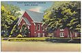
Postcard of First Methodist Church in Heflin (c. 1930-1945)
.jpg)
See also
 In Spanish: Heflin (Alabama) para niños
