Henderson, Maryland facts for kids
Quick facts for kids
Henderson, Maryland
|
|
|---|---|

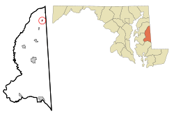
Location of Henderson, Maryland
|
|
| Country | |
| State | |
| County | |
| Incorporated | 1949 |
| Area | |
| • Total | 0.13 sq mi (0.32 km2) |
| • Land | 0.13 sq mi (0.32 km2) |
| • Water | 0.00 sq mi (0.00 km2) |
| Elevation | 56 ft (17 m) |
| Population
(2020)
|
|
| • Total | 160 |
| • Density | 1,280.00/sq mi (493.68/km2) |
| Time zone | UTC-5 (Eastern (EST)) |
| • Summer (DST) | UTC-4 (EDT) |
| ZIP code |
21640
|
| Area code(s) | 410 |
| FIPS code | 24-37925 |
| GNIS feature ID | 0590445 |
Henderson is a small town located in Caroline County, Maryland, in the United States. In 2020, about 160 people lived there. The town got its name from someone who owned shares in the Delaware and Chesapeake Railroad.
A historic place called Athol is also in Henderson. It was added to the National Register of Historic Places in 1989. This means it's an important site for history.
Contents
Henderson's Location and Size
Henderson is found at these coordinates: 39°4′26″N 75°45′59″W / 39.07389°N 75.76639°W. This helps pinpoint its exact spot on a map.
The United States Census Bureau says that the town covers a total area of about 0.13 square miles (0.32 square kilometers). All of this area is land, with no water.
People Living in Henderson
| Historical population | |||
|---|---|---|---|
| Census | Pop. | %± | |
| 1880 | 52 | — | |
| 1950 | 106 | — | |
| 1960 | 129 | 21.7% | |
| 1970 | 135 | 4.7% | |
| 1980 | 156 | 15.6% | |
| 1990 | 66 | −57.7% | |
| 2000 | 118 | 78.8% | |
| 2010 | 146 | 23.7% | |
| 2020 | 160 | 9.6% | |
| U.S. Decennial Census | |||
Population Details from 2010
According to the census from 2010, there were 146 people living in Henderson. These people lived in 44 different homes, and 28 of those were families.
The town had about 1123 people per square mile (434 people per square kilometer). There were 51 housing units, which means 51 places where people could live.
Most of the people in town, about 65.8%, were White. About 2.1% were African American, and 0.7% were Native American. A larger group, 30.8%, were from other races. About 37.0% of the population identified as Hispanic or Latino.
Out of the 44 homes, 38.6% had children under 18 years old living there. Almost half, 47.7%, were married couples. Some homes, 4.5%, had a female head of household without a husband. About 11.4% had a male head of household without a wife. The remaining 36.4% were not families.
About 22.7% of all homes had only one person living in them. And 6.8% of these single-person homes had someone 65 years or older living alone. On average, each home had 3.32 people, and each family had 3.64 people.
The average age of people in Henderson was 30 years old. About 23.3% of residents were under 18. About 13% were between 18 and 24. A large group, 34.2%, were between 25 and 44. About 23.9% were between 45 and 64. Finally, 5.5% were 65 years or older. The town had slightly more males (52.7%) than females (47.3%).
Getting Around Henderson
The main way to travel to and from Henderson is by road. The only state highway that goes through the town is Maryland Route 311. This road runs north and south through the area.
See also
 In Spanish: Henderson (Maryland) para niños
 | Aaron Henry |
 | T. R. M. Howard |
 | Jesse Jackson |


