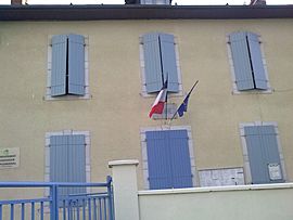
Herrère facts for kids
Quick facts for kids
Herrère
|
|
|---|---|
 |
|
| Country | France |
| Region | Nouvelle-Aquitaine |
| Department | Pyrénées-Atlantiques |
| Arrondissement | Oloron-Sainte-Marie |
| Canton | Oloron-Sainte-Marie-2 |
| Intercommunality | Haut Béarn |
| Area
1
|
8.93 km2 (3.45 sq mi) |
| Population
(Jan. 2019)
|
389 |
| • Density | 43.56/km2 (112.82/sq mi) |
| Time zone | UTC+01:00 (CET) |
| • Summer (DST) | UTC+02:00 (CEST) |
| INSEE/Postal code |
64261 /64680
|
| Elevation | 234–342 m (768–1,122 ft) (avg. 298 m or 978 ft) |
| 1 French Land Register data, which excludes lakes, ponds, glaciers > 1 km2 (0.386 sq mi or 247 acres) and river estuaries. | |
Herrère is a small village, also known as a commune, located in the southwestern part of France. It is part of the Pyrénées-Atlantiques département, which is like a county or administrative area in France.
Herrère is a quiet place with a population of about 389 people as of January 2019. It covers an area of 8.93 square kilometers (about 3.45 square miles). The village is situated at an elevation of around 298 meters (978 feet) above sea level.
What is a Commune?
A commune is the smallest administrative area in France. Think of it like a town or a village with its own local government. Each commune has a mayor and a town council that manage local services.
The Mayor of Herrère
The mayor of Herrère is Robert Laborde-Hondet. The mayor is the head of the local government. They are responsible for making decisions that help the community. This includes things like managing local roads, schools, and public services.
Where is Herrère Located?
Herrère is found in the Pyrénées-Atlantiques département. This area is known for its beautiful landscapes, including the Pyrenees mountains. The village is also close to the town of Oloron-Sainte-Marie. This larger town is the main center for the surrounding communes.
See also
 In Spanish: Herrère para niños
 | Anna J. Cooper |
 | Mary McLeod Bethune |
 | Lillie Mae Bradford |


