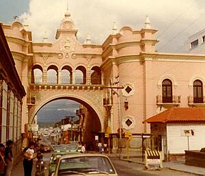
History of Guatemala City facts for kids
Guatemala City is the capital of Guatemala. People have lived here for a very long time, starting with the ancient Maya who built a city called Kaminaljuyu. Later, Spanish colonists founded a small town here. In 1775, it became the capital city. Important buildings like the Cathedral and Royal Palace were built around the Central Square. After Central America became independent from Spain in 1821, the city became the capital of the United Provinces of Central America.
During the 1800s, the city grew a lot. The grand Carrera Theater was built in the 1850s, and the Presidential Palace in the 1890s. The city expanded, and some native settlements had to move. Sadly, big earthquakes in 1917 and 1918 destroyed many old buildings. In the 1930s, under President Jorge Ubico, new public buildings and a horse track were constructed. However, many poor neighborhoods that formed after the earthquakes still lacked basic services.
In more recent times, during the Guatemalan Civil War, the city faced difficult times. In May 2010, two natural disasters hit: the Pacaya volcano erupted, and then Tropical Storm Agatha caused heavy rain and damage.
Contents
Ancient Maya City: Kaminaljuyu
Humans have lived in the area around modern-day Guatemala City for a very long time. As farming began, some early settlements grew into large, organized cities. You can still see proof of this in the western parts of Guatemala City. Here are the ruins of the ancient Maya city of Kaminaljuyu.
Archaeologists believe that the Maya first lived in Kaminaljuyu around 1500 BC. People continued to live there until about 1200 AD. This shows how important and long-lasting the city was.
The ancient city was very large and complex. Over time, the modern city of Guatemala City grew over and around many of its ruins. Many old temple mounds and other structures were covered by roads, shopping centers, and homes. However, the main ceremonial center of Kaminaljuyu is now protected by the Guatemalan government and is a park. This allows people to visit and learn about this amazing ancient city.
Spanish Colonial Times
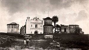
In the past, during the time of Spanish rule, Guatemala City was a small town. It had a monastery called El Carmen, built in 1620. The capital of the Spanish region, which covered most of modern Central America, was moved here in 1775. This happened after a series of strong earthquakes, known as the Santa Marta earthquakes, destroyed the old capital, Antigua.
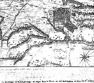
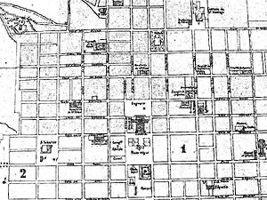
On September 27, 1775, King Charles III of Spain officially moved the capital. This new location was far from the volcanoes that caused the earthquakes, which meant the city could grow much larger. The new city was named Nueva Guatemala (New Guatemala).
Central Square: The Heart of the City
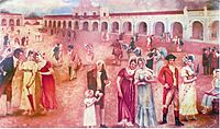
The Central Square was the most important civic and political center of Guatemala City. It served this role from its founding in 1776 until 1985. The main religious and government buildings were located around this square.
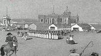
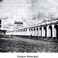
The cathedral, on the east side, was built between 1782 and 1815. Its tall towers were finished in 1867. This huge building has a mix of old European styles and has survived many earthquakes. On the west side, the Royal Palace was the main government building for the Capitanía of Guatemala. It was used from 1776 until the earthquakes of 1917 and 1918.
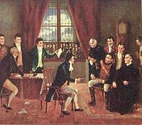
Guatemala City was also where Central America declared its independence from Spain in 1821. After this, it became the capital of the United Provinces of Central America.
15 September 1821
The 1800s
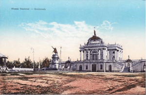
Carrera Theater
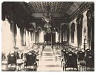
President Rafael Carrera, who loved opera, decided to build a huge National Theater. It was named "Carrera Theater" in his honor. The theater was located in the Old Central Square, which was the first chosen spot for the new city after the 1773 earthquakes. However, the Spanish crown later approved a different location for the main Central Square, so this area became the "Old" one.
Years later, in 1832, the governor tried to build a theater there, but political problems stopped the project. The idea came back in 1852 when Juan Matheu and Manuel Francisco Pavón Aycinena presented a new plan to President Carrera. Carrera approved it and hired experts to build the theater. This was the first very large building constructed in Guatemala after it became a republic. It was built in the 1850s, a time when the country was finally peaceful and doing well.
A travel guide from 1884 described the theater as being as big and elegant as any other in Spanish America. It was surrounded by orange trees, beautiful flowers, and statues, making it a lovely place.
After the Liberal reform in 1871, the theater was renamed the National Theater. In 1892, it was updated. The old coat of arms was removed, and new decorations were added. The orange trees and statues were replaced with modern gardens and a statue of a famous writer, José Batres Montúfar.
Later, under President Manuel Lisandro Barillas Bercián, the theater was remodeled again to celebrate 400 years since Christopher Columbus arrived in America. The Italian community in Guatemala donated a statue of Christopher Columbus, which was placed next to the theater. Since then, the place has been called "Colón Theater."
New Buildings and Expansion
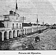
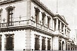
General José María Reina Barrios built several monuments to make the capital city more beautiful. These included the "30 de Junio" Boulevard, which celebrated the Liberal Reform of 1871, and the Presidential Palace. In 1895, Reyna Barrios hired an architect from Spain, José de Bustamante, to build the Presidential Palace and his home. Construction began on January 1, 1895, and was finished on December 24, 1896.
Sadly, most of these buildings from that time were destroyed by the powerful earthquakes of 1917–1918.
The 1900s
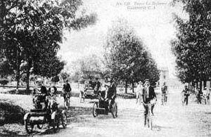
City Growth and the "30 de Junio" Boulevard
Wealthy families began to move their homes to the area around "30 de Junio" Boulevard, in the southern part of the city. Also, some native communities were moved from Santiago de los Caballeros de Guatemala and settled in the southeast. This created new neighborhoods like "San Pedrito" and "Ciudad Vieja."
Guatemala City also expanded a bit to the north, along "Simeón Cañas" Avenue. At the end of this avenue was the Temple of Minerva, where President Manuel Estrada Cabrera held student parades. The famous Guatemala Relief Map, a large map of the country, was also built in 1905. By the end of President Estrada Cabrera's time in office in 1920, Guatemala City had about 120,000 people.
The 1917–1918 Earthquakes
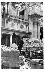
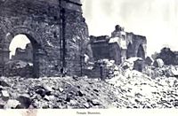
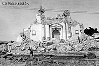
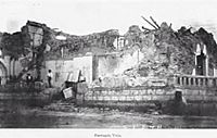
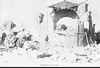
During the government of Manuel Estrada Cabrera (1898-1920), several important government buildings were constructed along 30 de Junio Boulevard. However, a series of powerful earthquakes from November 1917 to January 1918 changed everything. These quakes destroyed many public buildings, churches, and homes in Guatemala City and Antigua Guatemala.
Among the destroyed buildings were the Palace of La Reforma and the Joaquina maternity home. Because of these earthquakes, much of the city's historical buildings from that time were lost.
Jorge Ubico's Time
The Hipódromo del Sur (Southern Horse Track) was opened in 1923 by President José María Orellana. It was a very popular place for fun in "La Aurora" National Park. The track was 1,600 meters long and 30 meters wide, and its stands could hold 1,500 people. Visitors could watch horse shows, rodeos, and races. In 1926, President Lázaro Chacón ordered new facilities and improvements to the track to host more events and fairs.
In the early 1930s, during President Jorge Ubico's time, more improvements were made. A special presidential area and referee quarters were added. In 1935, an outdoor concert hall was built, and a yearly international fair was started. This fair had fun rides like roller coasters and cultural events, celebrating President Ubico's birthday on November 10.
During Ubico's presidency, the city continued to grow south. "La Aurora" International Airport and exhibition halls for the "November Fair" were built. Seventh Avenue was extended, and the "Torre del Reformador" and the "Charles the Fifth fountain" were moved to "Spain Plazuela." Ubico also built several important government buildings, including the National Palace, Police headquarters, Post Office headquarters, and the Supreme Court.
Wealthy families built their homes along "Avenida Reforma" (Reform Avenue). These homes were often made of wood in an American style to better resist earthquakes. This area had lots of open space, making it peaceful. However, many poor neighborhoods that formed after the 1917-18 earthquakes, like "La Parroquia" and "El Gallito," did not receive the same attention. Families in these areas lived in very difficult conditions.
Civil War in the City
The Guatemalan Civil War was a very difficult time for the country. On January 31, 1980, the Spanish Embassy in Guatemala City caught fire. This tragic event resulted in 37 deaths, including embassy staff and former government officials. A group of native people from El Quiché had occupied the embassy to draw attention to problems they faced with the army. After the fire, Spain ended its diplomatic relations with Guatemala.
On September 5, 1980, a group called the Ejército Guerrillero de los Pobres (EGP) carried out an attack in front of the Guatemalan National Palace. This was meant to stop people from supporting a large government demonstration. In this attack, six adults and a young boy died when two bombs in a vehicle exploded. Many people were injured, and there was a lot of damage to the National Palace and nearby buildings.
Attacks against businesses and banks also increased during these years. The groups behind these attacks saw these institutions as supporting the government.
| Date | Group | Target | Result |
|---|---|---|---|
| September 15, 1981 | Rebel Army Forces | National Financial Corporation (CORFINA) | Car bomb damaged the building and nearby financial institutions. |
| October 19, 1981 | EGP Urban guerilla | Industrial Bank Financial Center | Building damaged. |
| December 21, 1981 | EGP "Otto René Castillo" commando | New buildings: Chamber of Industry, Torre Panamericana (Bank of Coffee headquarters), and Industrial Bank Financial Center | Car bombs destroyed building windows. |
| December 28, 1981 | EGP "Otto René Castillo" commando | Industrial Bank Financial Center | Car bomb severely damaged one of the bank towers. |
Overpass Constructions
After the 1976 earthquake, Guatemala City began to grow very quickly. This led to serious traffic problems, especially during busy hours. To help with this, the City Hall started building overpasses, which are bridges that carry one road over another. The first one built during this time was the Tecún Umán overpass. It connects zones 8, 9, and 13 of the city. This structure has four concrete bridges and a special system to help traffic flow. The overpass was built in three stages, starting in October 1991 and finishing on August 31, 1993.
The 2000s
Pacaya Volcano Eruption of 2010
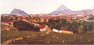
Four volcanoes can be seen from Guatemala City, and two of them are active. The closest and most active is Pacaya. It often sends out a lot of ash and rocks. The others are Volcán de Fuego, Acatenango, and Volcán de Agua.
On the night of May 27, 2010, Pacaya volcano erupted. The ash cloud reached 1,500 meters above the crater. This eruption greatly affected the city and three nearby regions. The International Airport had to close for five days because of the falling ash, rain, and poor visibility. Emergency teams declared a red alert for communities near the volcano and told people to leave.
The eruption caused two deaths, including a news reporter named Aníbal Archila. President Álvaro Colom declared a State of Emergency, and the Secretary of Education stopped classes in the affected regions: Guatemala, Escuintla, and Sacatepéquez.
Tropical Storm Agatha
Just two days after the Pacaya eruption, on May 29, 2010, Guatemala City was hit by Tropical Storm Agatha. This storm brought an extreme amount of rain in a very short time. The city's sewer system could not handle all the water. This caused a huge sinkhole that swallowed a complete house, killing its three occupants.
This sinkhole was at least 18 meters wide and 60 meters deep. It was large enough to swallow a three-story building and a house. Geologists believe that these recurring sinkholes in Guatemala City are caused by sewer leaks. These leaks erode the soft volcanic soil that makes up the ground in the Valle de la Ermita, where the city is located.
See also
- Santiago de los Caballeros de Guatemala
- Colonial Guatemala—Captaincy General of Guatemala
 | Aurelia Browder |
 | Nannie Helen Burroughs |
 | Michelle Alexander |


