Hobart Bay, Alaska facts for kids
Quick facts for kids
Hobart Bay, Alaska
|
|
|---|---|

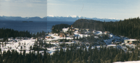
Aerial view of Hobart Bay.
|
|

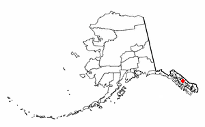
Location of Hobart Bay within Alaska.
|
|
| Country | United States |
| State | Alaska |
| Borough | Petersburg |
| Area | |
| • Total | 129.00 sq mi (334.10 km2) |
| • Land | 119.43 sq mi (309.31 km2) |
| • Water | 9.57 sq mi (24.79 km2) |
| Elevation | 1,184 ft (361 m) |
| Population
(2020)
|
|
| • Total | 1 |
| • Density | 0.01/sq mi (0.00/km2) |
| Time zone | UTC-9 (Alaska (AKST)) |
| • Summer (DST) | UTC-8 (AKDT) |
| Area code(s) | 907 |
| FIPS code | 02-32550 |
| GNIS feature ID | 1866951 |
Hobart Bay is a small area in Alaska, in the United States. It's known as a census-designated place, which means it's a special area the government uses to collect information about people.
In 2010, only one person lived there. This number was down from three people in 2000. Hobart Bay is now part of the Petersburg Borough.
History of Hobart Bay
Hobart Bay got its name in 1889. It was named by Lieutenant Commander Mansfield of the United States Navy.
The first people to settle here set up a logging camp. This means they cut down trees for wood. Over the years, fewer and fewer people have lived in Hobart Bay.
On January 3, 2013, Hobart Bay became part of the new Petersburg Borough. This new borough also included a big part of the Hoonah-Angoon Census Area. The main town for this area is Petersburg.
Where is Hobart Bay?
Hobart Bay is located in a specific spot in Alaska. Its coordinates are 57°27'11" North and 133°23'36" West.
The total area of Hobart Bay is about 129.8 square miles (334.1 square kilometers). Most of this area is land, about 117.4 square miles (309.31 square kilometers). The rest is water, which is about 12.4 square miles (24.79 square kilometers). This means about 9.54% of the area is water.
Who Lives in Hobart Bay?
| Historical population | |||
|---|---|---|---|
| Census | Pop. | %± | |
| 1990 | 187 | — | |
| 2000 | 3 | −98.4% | |
| 2010 | 1 | −66.7% | |
| 2020 | 1 | 0.0% | |
| source: | |||
Hobart Bay was first counted as a census-designated place in the 1990 U.S. Census. A census is like a big count of all the people living in an area.
In the year 2000, the census showed that three people lived in Hobart Bay. These three people made up two households and one family. The population density was very low, meaning there were almost no people per square kilometer.
There were also 17 housing units, which are places where people could live.
Of the three people living there in 2000, two were White and one was Native American.
The two households included one married couple living together. The other household had one male living alone.
The ages of the people in 2000 were:
- Two people were between 25 and 44 years old.
- One person was between 45 and 64 years old.
The average age of the people living there was 44 years old. There was one female and two males.
In 2000, the average income for a household in Hobart Bay was $68,750. The average income per person was $34,900.
See also
 In Spanish: Hobart Bay (Alaska) para niños


