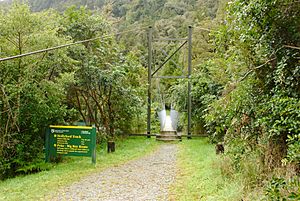
Hollyford Track facts for kids
The Hollyford Track is a famous walking trail in New Zealand. It's found in the northern part of Fiordland, which is in the southwest of the South Island. Unlike many other big trails in Fiordland, the Hollyford Track is mostly flat. This makes it easier to walk and you can visit it all year round. The track follows the Hollyford River through the beautiful Hollyford Valley.
History of the Hollyford Track
Early Settlers and Explorers
The Māori people were the first to live in the area around Martins Bay. By the mid-1800s, when Europeans arrived, only a few Māori still lived there. One important Māori person was Tūtoko, and a huge mountain, Mount Tūtoko, which is 2700 meters tall, was named after him.
The first Europeans to reach Martins Bay by land was Patrick Caples in 1863. He was from Hollyford, Ireland. Before him, David McKellar and George Gunn had already mapped parts of the valley. Also in 1863, a ship captained by Captain Alabaster sailed across the sandbar at Martins Bay to reach Lake McKerrow.
Jamestown and the McKenzie Family
In the early days, many Europeans hoped to build a busy port at Martins Bay. The Otago Provincial Council was very keen on this idea. They even planned a town called Jamestown and built some houses. However, there were no roads connecting it to other towns, and the sandbar was dangerous for ships. Because of this, Jamestown slowly became empty. By 1879, only about eleven years after it started, almost everyone had left.
Only one family, the McKenzies, stayed near Martins Bay. They later sold their land to Davey Gunn in 1926.
Davey Gunn and Tourism
Davey Gunn continued to farm the land. He also mapped the area and helped start the walking tourism business. He would take groups of walkers along the Hollyford, Pyke, and Cascade Rivers. After he passed away in 1955, his son Murray kept guiding walkers. Murray also started "Gunn's Camp." This camp is a place for walkers to rest, with a store and a small museum. It is still there today, close to the southern end of the track.
Track Upgrades and National Park Status
A gravel road was being built in the valley until 1941, when the workers were needed for World War II. After the war, the idea of a road linking Haast to Hollyford came up again. In 1960, the Hollyford Valley became part of Fiordland National Park. Davey Gunn's original walking paths were improved, and new huts were built for trampers to stay in.
Exploring the Hollyford Track
Track Length and Location
The Hollyford Track is 56 kilometers long. It runs mostly from south to north. You can reach the southern end by road, about 15 kilometers east of the Homer Tunnel. The northern end is at Martins Bay on the Tasman Sea coast, north of Milford Sound.
Scenery and Wildlife
For most of its journey, the track follows the Hollyford River through the Hollyford Valley. Along the way, you will see two lakes: Lake Alabaster (also called Waiwahuika) and Lake McKerrow (also called Whakatipu Waitai). Lake McKerrow used to be a fiord, but now it is cut off from the sea by sand and dirt.
The track goes through beautiful lowland forests. You can also enjoy amazing views of the mountains around you. If you are lucky, you might see some wildlife like seals, penguins, and herons.
Guided and Freedom Walking Options
The Hollyford Track is part of the Department of Conservation network. There are several huts along the track where walkers can stay.
There is also a guided trip run by Ngai Tahu Tourism. They have their own special lodges at Pyke and Martins Bay. This guided trip lasts three days and includes walking, jet boating, and even helicopter flights. It takes you from the mountains all the way to the sea.
If you prefer to walk on your own, you can make the trip easier by flying into or out of Martins Bay. Walkers should know that the section from the Pyke River to Martins Bay, next to Lake McKerrow, is known as the 'Demon Trail'. This part can be uneven and has many small streams. It can also be very slippery when it rains.
Road Proposals in the Area
Past and Present Ideas
For a long time, people have suggested building a road near the track. The idea is to connect Haast with the Milford Sound road. These ideas go back as far as the 1870s.
In 2001, a newspaper advertisement called "The South Island Loop" promoted the idea of a Hollyford road. Many mayors in the South Island and other supporters wanted the road to be built. However, Forest and Bird, a large conservation group in New Zealand, strongly opposed it. They said building the road would be like "smashing the Mona Lisa," meaning it would cause huge damage to nature.
In January 2010, the government at the time said they were thinking about a Hollyford road proposal. The Westland District Council and a hotel owner supported the plans. But in March 2010, the government decided that building the road was not a top priority, and the plans were put on hold.
 | Delilah Pierce |
 | Gordon Parks |
 | Augusta Savage |
 | Charles Ethan Porter |


