Houston Branch (Marshyhope Creek tributary) facts for kids
Quick facts for kids Houston Branch |
|
|---|---|

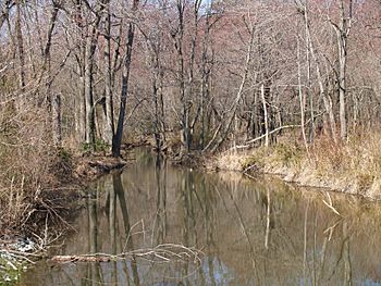
Houston Branch looking downstream towards Delaware Stateline from Handy Road
|
|
|
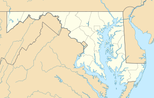
Location of Houston Branch mouth
|
|
| Other name(s) | Tributary to Marshyhope Creek |
| Country | United States |
| State | Maryland Delaware |
| Counties | Caroline Sussex |
| Physical characteristics | |
| Main source | divide between Houston Branch and Clear Brook (Nanticoke River) about 1 mile west of Atlanta, Delaware 40 ft (12 m) 38°42′27″N 075°41′07″W / 38.70750°N 75.68528°W |
| River mouth | Marshyhope Creek about 3 miles northeast of Nichols, Maryland 10 ft (3.0 m) 38°44′32″N 075°45′08″W / 38.74222°N 75.75222°W |
| Length | 6.47 mi (10.41 km) |
| Basin features | |
| Progression | southwest then northwest |
| River system | Nanticoke River |
| Basin size | 10.26 square miles (26.6 km2) |
| Tributaries |
|
Houston Branch is a small stream, also called a tributary. It flows into a larger waterway known as Marshyhope Creek. This branch is about 10.26 kilometers (or 6.47 miles) long. It starts in the state of Delaware and then flows west into Maryland.
Discovering Houston Branch
Houston Branch is an important part of the local water system. It helps carry water from the land into bigger rivers. This stream is a good example of how small waterways connect to larger ones.
Where it Starts and Ends
Houston Branch begins in western Sussex County, Delaware. Its starting point is about 1 mile west of a town called Atlanta, Delaware. The land here is about 40 feet (12 meters) above sea level. This is where the water first gathers to form the stream.
The stream's journey ends when it flows into Marshyhope Creek. This meeting point is in Caroline County, Maryland. It's located about 3 miles northeast of Nichols, Maryland. At this spot, the water is about 10 feet (3 meters) above sea level.
Its Journey and Basin
Houston Branch flows generally southwest at first. Then, it turns and flows northwest. As it travels, it collects water from a specific area of land. This area is called its basin. The basin for Houston Branch covers about 10.26 square miles (26.57 square kilometers).
The stream also has smaller streams that join it. These are called tributaries. On its right side, it receives water from a stream called Brights Branch. It also has other smaller, unnamed tributaries joining it from the left. All these waters eventually flow into Marshyhope Creek. Marshyhope Creek is part of the larger Nanticoke River system.
 | Leon Lynch |
 | Milton P. Webster |
 | Ferdinand Smith |


