Howe, Oklahoma facts for kids
Quick facts for kids
Howe, Oklahoma
|
|
|---|---|
 |
|

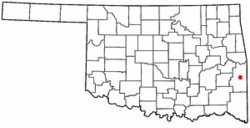
Location of Howe, Oklahoma
|
|
| Country | United States |
| State | Oklahoma |
| County | Le Flore |
| Area | |
| • Total | 1.49 sq mi (3.85 km2) |
| • Land | 1.49 sq mi (3.85 km2) |
| • Water | 0.00 sq mi (0.00 km2) |
| Elevation | 489 ft (149 m) |
| Population
(2020)
|
|
| • Total | 625 |
| • Density | 420.03/sq mi (162.23/km2) |
| Time zone | UTC-6 (Central (CST)) |
| • Summer (DST) | UTC-5 (CDT) |
| ZIP code |
74940
|
| Area code(s) | 539/918 |
| FIPS code | 40-36150 |
| GNIS feature ID | 2412772 |
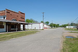
Howe is a small town in Le Flore County, Oklahoma, in the United States. It is part of the larger Fort Smith, Arkansas-Oklahoma area. In 2020, about 625 people lived there. Howe was once known for making coal and coke, which is a type of fuel. Today, farming is the main way people in Howe make a living.
History of Howe
This area was first a town of the Choctaw Nation called Klondike. In 1895 and 1896, a railroad called the Kansas City, Pittsburgh and Gulf Railroad built tracks through the town. The people then decided to rename their town Howe. They named it after Dr. Herbert M. Howe, who was a director for the railroad company.
A post office opened in Howe, Indian Territory, in 1898. A few years later, in 1900, the Kansas City Southern Railroad bought the Kansas City, Pittsburgh and Gulf Railroad.
In 1900, Howe had 626 residents. The number of people living there changed over the years. By 1910, it went down to 538, but then grew to 711 by 1920. Howe used to have its own newspaper, called the Howe Herald. It also had four doctors, four drugstores, a bank, two hotels, and two places to process cotton.
In 1961, a very strong tornado, called an F4 tornado, hit Howe and a nearby village. Thirteen people in Howe died, and 57 were hurt. At least 50 homes were destroyed. Even after this disaster, Howe's population started to grow again. By 1980, there were 562 residents, and by 2010, the population reached 802.
Howe's Location
Howe is located in Le Flore County. The town covers an area of about 1.5 square miles (3.9 km2), which is all land. It is about 8 miles (13 km) north of Heavener and 7 miles (11 km) south of Poteau.
Population Information
The word "demographics" means information about a population, like how many people live somewhere, their ages, and their backgrounds.
Here's how Howe's population has changed over the years:
| Historical population | |||
|---|---|---|---|
| Census | Pop. | %± | |
| 1900 | 626 | — | |
| 1910 | 538 | −14.1% | |
| 1920 | 711 | 32.2% | |
| 1930 | 692 | −2.7% | |
| 1940 | 640 | −7.5% | |
| 1950 | 486 | −24.1% | |
| 1960 | 390 | −19.8% | |
| 1970 | 403 | 3.3% | |
| 1980 | 562 | 39.5% | |
| 1990 | 510 | −9.3% | |
| 2000 | 697 | 36.7% | |
| 2010 | 802 | 15.1% | |
| 2020 | 625 | −22.1% | |
| U.S. Decennial Census | |||
In 2000, there were 697 people living in Howe. There were 243 households, and 178 of these were families. About 35% of households had children under 18. Many households were married couples living together.
The average age of people in Howe in 2000 was 32 years old. About 29% of the population was under 18, and 10% was 65 or older.
Howe's Economy
At the start of the 1900s, Howe's economy was based on producing coal, coke, cotton, and potatoes. The Lincoln Coal Company ran the local coal mines and also made charcoal briquettes. Farming continued to be the main part of the local economy throughout the century. In 1967, the Howe Coal Company made a deal to supply coal to steel mills in Japan for 13 years.
See also
 In Spanish: Howe (Oklahoma) para niños

