Howe, Indiana facts for kids
Quick facts for kids
Howe, Indiana
|
|
|---|---|

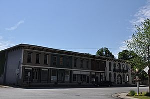
Shops in the center of Howe
|
|

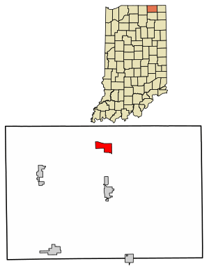
Location in LaGrange County, Indiana
|
|
| Country | United States |
| State | Indiana |
| County | LaGrange |
| Township | Lima |
| Area | |
| • Total | 1.79 sq mi (4.63 km2) |
| • Land | 1.79 sq mi (4.63 km2) |
| • Water | 0.00 sq mi (0.00 km2) |
| Elevation | 876 ft (267 m) |
| Population
(2020)
|
|
| • Total | 610 |
| • Density | 341.16/sq mi (131.74/km2) |
| ZIP code |
46746
|
| FIPS code | 18-34978 |
| GNIS feature ID | 2629774 |
Howe is a small community in Indiana, United States. It is known as a census-designated place. This means it is an area that the government uses to collect population data. Howe is located in LaGrange County, within Lima Township. In 2020, about 610 people lived there.
Contents
History of Howe
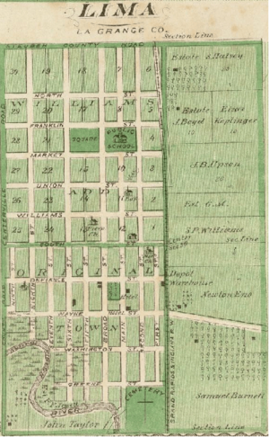
Howe was first settled in the year 1834. Back then, it had a different name: "Mongoquinong". This name came from the Potawatomi people, who used it for the prairie land in northeastern Indiana.
Soon after, the community was renamed "Lima". For a time, Lima was the county seat of LaGrange County. A county seat is the main town where the county government offices are located. Later, the community was renamed "Howe". It was named after John B. Howe, who was a local lawyer.
The Howe Military School is a very famous place in the community. It was started in 1884. This school has been an important part of Howe's history for many years.
Historic Places in Howe
Several places in Howe are listed on the National Register of Historic Places. This is a special list of buildings, sites, and objects that are important in American history. These places are protected and preserved.
Some of the historic sites in Howe include:
- John Badlam Howe Mansion, also known as the Howe Military School Rectory
- Lima Township School
- St. James Memorial Chapel
- Star Milling and Electric Company Historic District
- Samuel P. Williams House
- Kingsbury Hotel
Geography of Howe
Howe is located in the northern part of LaGrange County. You can find it where State Road 120 and State Road 9 cross. It is the main community in Lima Township.
The community is about 2 miles (3.2 km) south of Interstate 80/90, which is also known as the Indiana Toll Road. It is also about 5 miles (8 km) north of LaGrange, which is the county seat.
The U.S. Census Bureau says that the Howe census-designated place covers an area of about 1.79 square miles (4.6 square kilometers). All of this area is land. The Pigeon River flows along the southern edge of Howe. This river is a branch of the St. Joseph River.
Population and Demographics
Demographics is the study of a population, including facts like how many people live somewhere and how old they are.
Howe's population has changed over time.
| Historical population | |||
|---|---|---|---|
| Census | Pop. | %± | |
| 2010 | 807 | — | |
| 2020 | 610 | −24.4% | |
| U.S. Decennial Census | |||
In 2010, the population of Howe was 807 people. By 2020, the population had decreased to 610 people. These numbers come from the official United States Census, which counts everyone living in the country every ten years.
See also
 In Spanish: Howe (Indiana) para niños
 | Misty Copeland |
 | Raven Wilkinson |
 | Debra Austin |
 | Aesha Ash |


