Huriel facts for kids
Quick facts for kids
Huriel
|
||
|---|---|---|

Roman dungeon
|
||
|
||
| Country | France | |
| Region | Auvergne-Rhône-Alpes | |
| Department | Allier | |
| Arrondissement | Montluçon | |
| Canton | Huriel | |
| Intercommunality | Pays d'Huriel | |
| Area
1
|
34.92 km2 (13.48 sq mi) | |
| Population
(2008)
|
2,471 | |
| • Density | 70.762/km2 (183.27/sq mi) | |
| Time zone | UTC+01:00 (CET) | |
| • Summer (DST) | UTC+02:00 (CEST) | |
| INSEE/Postal code |
03128 /03380
|
|
| Elevation | 210–418 m (689–1,371 ft) (avg. 332 m or 1,089 ft) |
|
| 1 French Land Register data, which excludes lakes, ponds, glaciers > 1 km2 (0.386 sq mi or 247 acres) and river estuaries. | ||
Huriel is a small town in France. It is a French commune located in the Allier department. This department is in the central part of France.
Contents
About Huriel
Huriel is a charming commune with a rich history. It is known for its beautiful old buildings and peaceful surroundings. The town is part of the Allier department. This area is famous for its green landscapes and traditional French villages.
Location and Geography
Huriel is situated in the heart of France. Its exact location is shown by its coordinates: 46.3739 degrees north and 2.4775 degrees east. The town sits at an average height of 332 meters (about 1,089 feet) above sea level. The lowest point in the commune is 210 meters, and the highest is 418 meters.
The total area of Huriel is 34.92 square kilometers (about 13.48 square miles). This makes it a medium-sized commune in terms of land area.
Population
As of 2008, Huriel had a population of 2,471 people. The number of people living in a commune can change over time. This population count helps us understand the size of the community.
Local Government
Huriel is governed by a mayor and a local council. The mayor is the head of the town's government. From 2008 to 2014, the mayor of Huriel was Gérard Bourricat. The mayor and council work to manage the town's services. These services include things like schools, roads, and public spaces.
The commune is part of the canton of Huriel. A canton is a smaller administrative area within a department. It is also part of the arrondissement of Montluçon. An arrondissement is a larger administrative division.
Huriel is also part of an intercommunality called "Pays d'Huriel." This means it works together with nearby communes. They cooperate on projects that benefit the whole area.
History and Landmarks
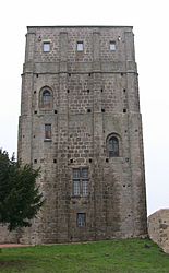
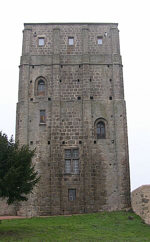
Huriel has a long history, which you can see in its buildings. One of its most famous landmarks is the Roman dungeon. This old tower is a reminder of the town's past. It shows how people lived and built structures many centuries ago.
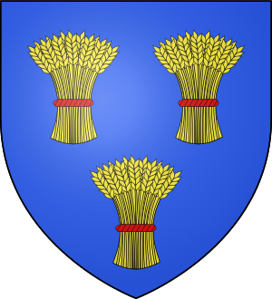
The town's coat of arms,
, also tells a story. It often represents the history and important families of the area.
See also
 In Spanish: Huriel para niños
 | Ernest Everett Just |
 | Mary Jackson |
 | Emmett Chappelle |
 | Marie Maynard Daly |


