IV postcode area facts for kids
Quick facts for kids
Inverness
|
|
|---|---|
| Country | United Kingdom |
| Postcode area |
IV
|
| Postcode area name |
Inverness
|
| Post towns | 31 |
| Postcode districts | 53 |
| Postcode sectors | 84 |
| Postcodes (live) | 7,356 |
| Postcodes (total) | 10,739 |
| Statistics as at May 2020 | |
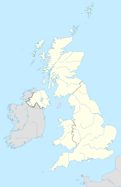
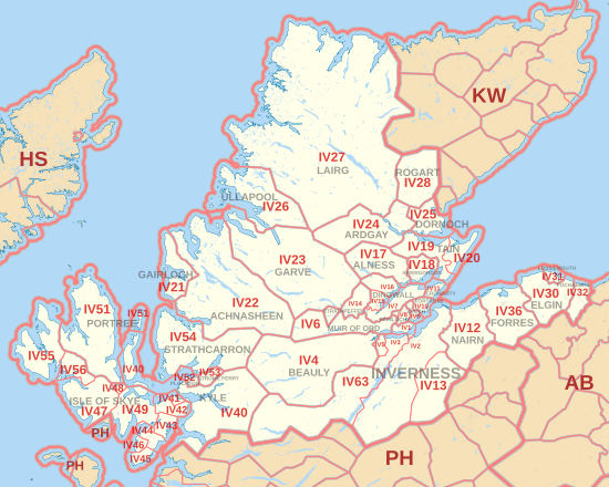
The IV postcode area, also known as the Inverness postcode area, is a special group of codes used by the post office. These codes help mail get to the right places in northern Scotland. The IV area covers many towns like Inverness, Elgin, Nairn, and even parts of the Isle of Skye.
Contents
What Do Postcodes Do?
Postcodes are like special addresses for different areas. They help postal workers sort letters and packages quickly. Each postcode area has many smaller "postcode districts." For example, the IV area has 52 different districts.
Finding Your Way with IV Postcodes
The IV postcode area covers a large part of northern Scotland. It includes towns in the Highland region and some in Moray. Each postcode district helps narrow down exactly where a letter needs to go.
Here are a few examples of towns and areas covered by IV postcodes:
| Postcode district | Post town | Coverage | Local authority area(s) |
|---|---|---|---|
| Postcode District | Main Post Town | Areas Covered | Council Area |
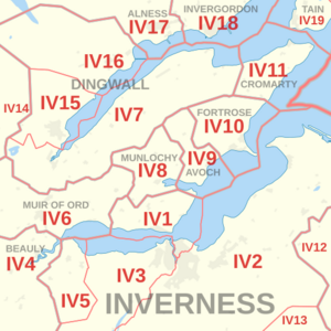
| IV1 | INVERNESS | Inverness city centre and northern parts, including North Kessock | Highland |
| IV2 | INVERNESS | Eastern Inverness, plus Culloden and Ardersier | Highland |
| IV3 | INVERNESS | Western Inverness, including Dochgarroch | Highland |
| IV4 | BEAULY | Beauly, Kiltarlity, and nearby villages | Highland |
| IV15 | DINGWALL | The town of Dingwall | Highland |
| IV17 | ALNESS | The town of Alness | Highland |
| IV18 | INVERGORDON | The town of Invergordon | Highland |
| IV25 | DORNOCH | The town of Dornoch | Highland |
| IV26 | ULLAPOOL | The fishing town of Ullapool | Highland |
| IV27 | LAIRG | Lairg, Durness, Tongue, and Scourie | Highland |
| IV30 | ELGIN | The town of Elgin | Moray |
| IV31 | LOSSIEMOUTH | The town of Lossiemouth | Moray |
| IV36 | FORRES | The town of Forres | Moray |
| IV40 | KYLE | Kyle of Lochalsh and the island of Raasay | Highland |
| IV51 | PORTREE | Portree and Uig on the Isle of Skye | Highland |
| IV55 | ISLE OF SKYE | Dunvegan on the Isle of Skye | Highland |
| IV63 | INVERNESS | Drumnadrochit and Invermoriston (near Loch Ness) | Highland |
Changes to Postcode Areas
Sometimes, postcode areas can change. For example, some small areas that used to be part of the IV postcode (like Carron, Knockando, and Rothes) were moved. In 1994, they became part of the AB38 postcode area, which belongs to Aberlour. This helps keep the postal system organized.
The UK's Largest Postcode Area
Did you know that one part of the IV postcode area is the biggest in the whole United Kingdom? The IV27 district, which includes Lairg, covers a huge area of about 1,393 square miles! That's a lot of ground to cover for mail delivery!
Map of the Area
This map shows you where the IV postcode area is located in Scotland. It helps you see all the different districts and towns it covers.
See also
- Postcode Address File
- List of postcode areas in the United Kingdom
 | Isaac Myers |
 | D. Hamilton Jackson |
 | A. Philip Randolph |


