Ibapah Peak (Juab County, Utah) facts for kids
Quick facts for kids Ibapah Peak |
|
|---|---|
 |
|
| Highest point | |
| Elevation | 12,018 ft (3,663 m) |
| Prominence | 5,247 ft (1,599 m) |
| Isolation | 61.18 mi (98.46 km) |
| Parent peak | Doso Doyabi |
| Listing | Ultra |
| Geography | |
| Parent range | Deep Creek Range |
| Topo map | USGS Ibapah Peak |
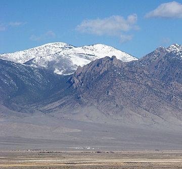
Ibapah Peak is a very tall mountain in Utah, United States. It stands 12,018-foot (3,663 m) high. This makes it a really big "summit," which is another word for a mountain's highest point. Ibapah Peak is found in Juab County.
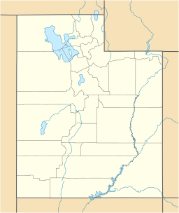
This peak is the highest point in the Deep Creek Range. It is located close to the border between Utah and Nevada. The mountain is about 5 miles (8.0 km) east of the border. It is also about 10 miles (16 km) northwest of a small town called Trout Creek, Utah.
Contents
What is Ibapah Peak?
Ibapah Peak is a prominent mountain. When we say a mountain is "prominent," it means it stands out a lot from the land around it. It has a "topographic prominence" of 5,247 feet (1,599 m). This measurement shows how much higher a mountain is compared to the lowest point connecting it to any higher peak.
How Prominent is Ibapah Peak?
Ibapah Peak is the fifth-most prominent mountain in all of Utah. This means only four other mountains in the state stand out more. Its high prominence makes it a very noticeable feature in the landscape.
Where is Ibapah Peak Located?
Ibapah Peak is part of the Deep Creek Range. This mountain range is in western Utah. It stretches near the Utah-Nevada state line. The area around the peak is mostly remote and rugged.
The Deep Creek Mountains
The Deep Creek Mountains are a range of tall peaks. They rise sharply from the surrounding desert. These mountains are known for their beautiful, wild scenery. They are also home to various plants and animals.
See also
 In Spanish: Ibapah Peak para niños
 | Bessie Coleman |
 | Spann Watson |
 | Jill E. Brown |
 | Sherman W. White |


