
Image: Chatham-Islands map topo en

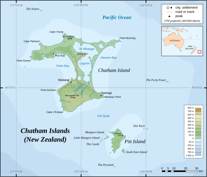
Description: Topographic Map of Chatham Islands. The archipelago of the Chatham Islands, consists of about 10 islands within a 40-km radius. The islands have officially belonged to New Zealand since 1842. Scale ca 1:1.000.000
Title: Chatham-Islands map topo en
Credit: Own work Topographic map: NASA Shuttle Radar Topography Mission (SRTM3 v.2) (public domain), Bathymetry: ETOPO2v2 2min - vectorized with Inkscape ; UTM projection ; WGS84 datum Other references used for additional data : vmap0 (Vector Map Level 0) Land Information New Zealand
Author: Alexrk
Permission: Creative Commons : share alike - attribution required
Usage Terms: Creative Commons Attribution-Share Alike 2.5
License: CC BY-SA 2.5
License Link: https://creativecommons.org/licenses/by-sa/2.5
Attribution Required?: Yes
Image usage
The following 12 pages link to this image:
