
Image: DeSoto Map Leg 2 HRoe 2008
No higher resolution available.
DeSoto_Map_Leg_2_HRoe_2008.jpg (600 × 470 pixels, file size: 290 KB, MIME type: image/jpeg)
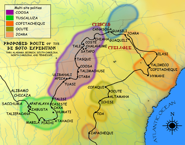
Description: A map showing the de Soto expedition route through the future U.S. states of Georgia, South Carolina, North Carolina, Tenesse, and Alabama. Based on the Charles M. Hudson map of 1997.
Title: DeSoto Map Leg 2 HRoe 2008
Credit: Own work (Original text: I created this work entirely by myself.)
Author: Heironymous Rowe (talk)
Usage Terms: Creative Commons Attribution-Share Alike 3.0
License: CC BY-SA 3.0
License Link: http://creativecommons.org/licenses/by-sa/3.0
Attribution Required?: Yes
Image usage

All content from Kiddle encyclopedia articles (including the article images and facts) can be freely used under Attribution-ShareAlike license, unless stated otherwise.