Coosa chiefdom facts for kids

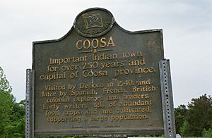
The Coosa chiefdom was a strong Native American group that lived in what is now Gordon and Murray counties in Georgia, United States. It existed from about the year 1400 to 1600. This chiefdom was very powerful and ruled over several smaller groups. Experts believe that about 50,000 people lived in the area that Coosa influenced, which reached into parts of present-day Tennessee and Alabama.
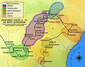
European explorers visited Coosa several times. Hernando de Soto and his conquistadors (Spanish explorers and soldiers) came through in 1539–1541. Later, explorers from the Tristán de Luna expedition visited in 1560, and the Juan Pardo expedition came in 1566–1568. These Europeans wrote about what they saw. They described Coosa as many small communities with rich gardens full of food, rather than one big city.
The name Coosa was also used for one of the four main towns of the Muscogee Creek confederacy.
History of the Coosa Chiefdom


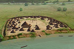
The main center of the Coosa chiefdom was located along the Coosawattee River. This area is in what is now northwestern Georgia. The capital of Coosa was a large settlement. It had a big open area called a plaza and three platform mounds, which were large, flat-topped hills built by people. There were also many homes.
Archaeologists have found different types of pottery from the Mississippian culture at this site. These findings show that people lived there from about 1300 to 1600. Archaeologists sometimes call this settlement "Little Egypt." They have learned a lot about the Coosa people from the pottery and other items they left behind.
European Contact and Changes
When Hernando de Soto and his group arrived in 1540, they wrote that the Coosa chiefdom had eight villages. Archaeologists have found the remains of seven of these villages, including the capital. At that time, between 2,500 and 4,650 people are thought to have lived in the Coosa chiefdom itself.
However, the chief of Coosa also ruled over a much larger group of other chiefdoms. This larger group stretched about 400 miles along the Appalachian Mountains. It covered parts of northern Georgia, eastern Tennessee, and central Alabama. In total, this "paramount chiefdom" included about 50,000 people.
After the Europeans arrived, new diseases came with them. The Native American people had never been exposed to these diseases before. Many people in Coosa and the surrounding chiefdoms got very sick and died. This caused a huge decline in their population and greatly disrupted their way of life.
By the end of the 1500s, most of the Coosa's main territory was empty. The people who survived moved to a few villages along the Coosa River in Alabama. One of these villages was the King site. It was a small, strongly protected village with about 277 to 517 people and 47 houses.
The Name Coosa
The explorers from the de Soto Expedition wrote the name of the Coosa people as Coça. Later, French maps showed some towns of the Creek Confederacy as "Cousha" or "Coushetta." These were ways the French wrote the name as they heard it.
The Cherokee people also used the word kusa. They used it to mean the Muskogee Creek people of the Upper Towns, who were sometimes their rivals. According to James Mooney, the Cherokee called the Muskogee Creek "Ani'-Ku'sa" or "Ani'-Gu'sa," because of their main town, Kusa. English speakers then started using "Coosa" as their version of the Cherokee word. Today, the Cherokee name for all Creek Indians is still ani-kusa. This is also the name for Muskogee, Oklahoma.
 | Claudette Colvin |
 | Myrlie Evers-Williams |
 | Alberta Odell Jones |

