Coosawattee River facts for kids
Quick facts for kids Coosawattee River |
|
|---|---|

|
|
| Country | United States |
| State | Georgia |
| County | Gilmer, Gordon, & Murray |
| Physical characteristics | |
| Main source | confluence of the Ellijay and Cartecay rivers Ellajay 575 ft (175 m) 34°41′29″N 84°29′01″W / 34.6914744°N 84.4835388°W |
| River mouth | Oostanaula River at Carters Lake 1,073 ft (327 m) 34°36′18″N 84°38′00″W / 34.6050863°N 84.6332661°W |
| Length | 49.3 mi (79.3 km) |
| Basin features | |
| Tributaries |
|
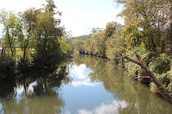
The Coosawattee River is a river about 49 miles (79 km) long. It flows through northwestern Georgia, in the United States.
Contents
Discovering the Coosawattee River
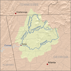
The Coosawattee River starts in the city of Ellijay. This is in central Gilmer County. It begins where two other rivers, the Ellijay and Cartecay rivers, meet. This meeting point is called a confluence.
Where the River Flows
From Ellijay, the Coosawattee River flows west. It winds through the rolling hills of the North Georgia mountains region. The Coosawattee is a tributary of the Oostanaula River. A tributary is a smaller river or stream that flows into a larger river. The Oostanaula River then flows into the Coosa River.
Many smaller streams and creeks flow into the Coosawattee River. These are its tributaries. Some of them include Mountaintown Creek, Tails Creek, Cole Creek, and Talking Rock Creek. Other tributaries are Salacoa Creek and Crane Eater Creek.
Carters Lake and Dam
In Murray County, the river is held back by a very large structure. This structure is called Carters Dam. The dam creates a big lake behind it, known as Carters Lake. Most of this lake is actually in Gilmer County.
Carters Dam was finished in 1977. It is special because it is the tallest earthen dam east of the Mississippi River. An earthen dam is built mostly from compacted earth and rock. After leaving the dam, the Coosawattee River flows west. It goes directly into the Reregulation Reservoir, which is part of the dam system. The river then forms the border between Murray and Gordon County. Finally, it enters Gordon County.
Meeting Other Rivers
Near a historic place called New Echota, the Coosawattee River meets the Conasauga River. When these two rivers join, they form the Oostanaula River. As mentioned before, the Oostanaula River then flows into the Coosa River.
Historical Importance of the Area
The area around the Coosawattee River was very important. It was a central part of the Cherokee Nation territory. This territory covered parts of north Georgia and southeastern Tennessee. In the early 1820s, the Cherokee people moved here. They had been forced to give up their lands in eastern Tennessee. They made New Echota their capital city.
Coosawattee River in Books and Movies
The Coosawattee River has even been part of popular culture! American writer James Dickey used the Coosawattee River as inspiration. He created a fictional river called the "Cahulawassee River" in his book, Deliverance. This book was published in 1970. Later, in 1972, the book was made into a movie. It was also called Deliverance and was directed by John Boorman.
 | Anna J. Cooper |
 | Mary McLeod Bethune |
 | Lillie Mae Bradford |


