Coosa River facts for kids
Quick facts for kids Coosa River |
|
|---|---|
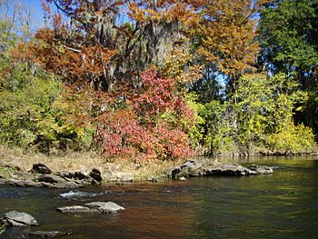
Fall colors on the Coosa River near Wetumpka, Alabama
|
|
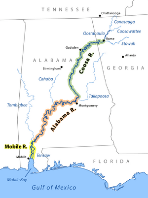
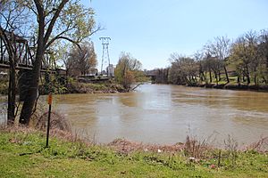
The Coosa River is the major tributary when it joins the Tallapoosa River near Wetumpka, Alabama to form the Alabama River.
|
|
| Country | United States |
| State | Alabama, Georgia |
| Physical characteristics | |
| Main source | junction of Oostanaula River and Etowah River at Rome, Georgia 575 ft (175 m) 34°15′14″N 85°10′39″W / 34.25389°N 85.17750°W |
| River mouth | Alabama River near Montgomery, Alabama 121 ft (37 m) 32°29′10″N 86°16′40″W / 32.48611°N 86.27778°W |
| Length | 280 mi (450 km) |
| Basin features | |
| Basin size | 10,100 sq mi (26,000 km2) |
The Coosa River is a major river in the United States. It flows through the states of Alabama and Georgia. The river is about 280 miles (450 km) long.
The Coosa River starts where the Oostanaula River and Etowah River meet in Rome, Georgia. It ends near Montgomery, Alabama, where it joins the Tallapoosa River. Together, they form the Alabama River just south of Wetumpka, Alabama. Most of the Coosa River, about 90%, is in Alabama. Coosa County, Alabama is named after this river.
The Coosa is one of Alabama's most developed rivers. Much of it has been changed by dams. Alabama Power owns seven dams and powerhouses on the river. These dams create hydroelectric power, which is electricity made from moving water. However, these dams have affected some unique animal species that only live in the Coosa River.
Contents
The Coosa River's Past
Native Americans lived in the Coosa Valley for thousands of years. The first Europeans to visit were Hernando de Soto and his men in 1540. At that time, the Coosa chiefdom was one of the strongest groups in the southeastern United States.
Early European Influence
About 100 years after the Spanish left, the British started trading with the Muscogee Creek people. This began in the late 1600s. France also had settlements nearby, like in Mobile, Alabama. The French wanted to control the Coosa River. They saw it as a key path to the entire South. Boats were the main way to travel back then.
The Coosa and Tallapoosa rivers join to form the Alabama River. This river flows into Mobile Bay, which the French used for travel. Both France and Britain wanted to control these important rivers.
Conflicts and Changes
In the early 1700s, trade between Europeans and Native Americans stopped during the Yamasee War. This war was against the British colony of Carolina. After a few years, trade started again with new rules. The fight between France and Britain over the Coosa Valley continued. Britain finally won against France in the Seven Years' War (also called the French and Indian War). As a result, France gave up its lands east of the Mississippi River to Britain in 1763. This was part of the Treaty of Paris.
By the end of the American Revolutionary War, the Creek people lived in the lower Coosa Valley. The Cherokee people lived in the upper part, near where the river starts in Georgia. Both groups felt pressure from European-American settlers moving onto their lands.
Native American Removal
After the Fort Mims massacre, General Andrew Jackson led American troops and Cherokee allies against the Creek. This led to the Creek's defeat at the Battle of Horseshoe Bend. In 1814, the Treaty of Fort Jackson forced the Creek to give up a lot of land to the United States. They kept a small area between the Coosa and Tallapoosa rivers. But even there, settlers illegally moved onto their land.
In the 1820s and 1830s, the Creek, Cherokee, and other Native American groups were forced to move to Indian Territory (now Oklahoma). The Cherokee's journey is known as the Trail of Tears. The Cherokee capital city, New Echota, was on a river that feeds into the Coosa. After these removals, the Coosa River valley was open for American settlers.
Cotton and River Travel
The invention of the cotton gin in the early 1800s made growing cotton very profitable. Cotton could grow well in the South's uplands, and there was a high demand for it. Many people moved to Alabama, a time called "Alabama Fever." They created large cotton farms worked by enslaved African Americans.
The first town on the Coosa River was Wetumpka, Alabama. Its name means "rumbling waters." It was built at the last waterfall on the river, called the "Devil's Staircase."
The Coosa River was important for transportation until the early 1900s. Riverboats traveled for 200 miles south from Rome. However, waterfalls like the Devil's Staircase stopped boats from reaching the Alabama River and the Gulf of Mexico.
Dams and Health
In the early 1900s, Alabama Power built dams on the Coosa River, like Lay, Mitchell, and Jordan dams. They also developed new ways to control malaria, a big health problem in rural Alabama. Their methods were so successful that the League of Nations visited Alabama to study them.
Interestingly, the Popeye the Sailorman cartoons were inspired by Tom Sims. He was a Coosa River resident from Rome, Georgia. He knew about riverboat life and the people who lived along the river in the early 1900s.
Coosa River Dams and Lakes
The Coosa River has seven dams built by the Alabama Power Company. These dams create large lakes. Before 1912, only 72 communities in Alabama had electricity. By 1928, when Jordan Dam started working, Alabama Power provided electricity to 421 communities in 61 counties. This power helped many industries and created jobs for thousands of people.
| Impoundment/Section | Description | Images |
|---|---|---|
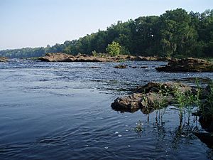
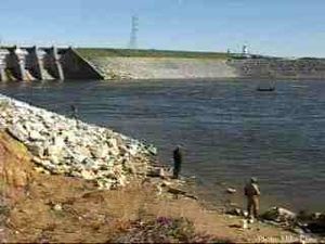
| Jordan Dam Tailwater | This section flows about 7.5 miles (12 km) into Wetumpka, Alabama. It has pools, shallow areas, and rapids. Alabama Power releases water from Jordan Dam for whitewater boating and to help aquatic life. This part of the river has the Moccasin Gap rapids, which are Class III whitewater (medium difficulty). | |
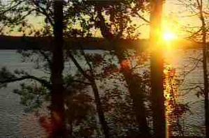
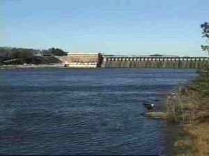
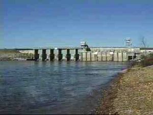
| Lake Jordan | Lake Jordan was created on December 31, 1928. It was named after the mother of Reuben and Sidney Mitchell, who helped build Mitchell Dam. The dam is 125 feet (38 m) high. The lake covers 6,800 acres (28 km2) and has 180 miles (290 km) of shoreline. The closest town is Wetumpka, Alabama. Lake Jordan is used for recreation and fishing. You can catch largemouth bass, spotted bass, bluegill, crappie, catfish, and striped bass. It hosted the 2004 Bass Masters Classic Tournament. | |
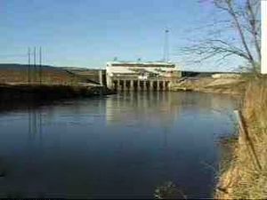
| Lake Bouldin | Lake Bouldin was created on July 27, 1967, and named for Walter Bouldin. It is connected to Lake Jordan by two man-made canals. Bouldin Dam added more power to the Lake Jordan system. In 1975, a part of the dam broke, emptying the lake. No one was hurt, and the dam was rebuilt later. | |
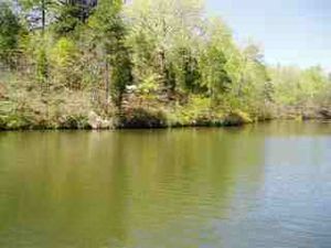
| Lake Mitchell | Lake Mitchell was created on August 15, 1923. It was named after James Mitchell, a former president of Alabama Power. The lake covers 5,850 acres (24 km2) and has 147 miles (237 km) of shoreline. The closest town is Clanton, Alabama. Lake Mitchell is also a popular spot for fishing. | |
| Lay Lake | Lay Lake was created in 1914 and named after Captain William Patrick Lay, the first president of Alabama Power. It covers 12,000 acres (49 km2) and has 289 miles (465 km) of shoreline. The closest town is Columbiana, Alabama. Lay Lake is a great place for fishing. Lay Dam was one of the first concrete dams in the U.S. Its construction helped develop new dam-building methods. | |
| Lake Logan Martin | Lake Logan Martin was created on August 10, 1964. It was named after William Logan Martin, Jr., a judge and attorney general for Alabama. The lake covers 15,263 acres (61.8 km2) and has 275 miles (443 km) of shoreline. The closest town is Pell City, Alabama. This lake is also a popular fishing spot. | |
| Lake Neely Henry | Lake Neely Henry was created on June 2, 1966. It was named for H. Neely Henry, an executive at Alabama Power. The lake covers 11,200 acres (45.3 km2) and has 339 miles (546 km) of shoreline. The closest town is Ohatchee, Alabama. Lake Neely Henry is another good lake for fishing. | |
| Weiss Lake | Weiss Lake was created on June 5, 1961. It was named for F.C. Weiss, a former chief engineer of Alabama Power. This is the largest lake on the Coosa, covering 30,200 acres (122 km2) with 447 miles (719 km) of shoreline. The closest town is Leesburg, Alabama. Weiss Lake is famous for its crappie fishing and is often called the “Crappie Capital of the World.” |
Amazing Plants and Animals of the Coosa River
The Coosa River Watershed is home to many rare plants and animals. Over 280 types of rare species and natural areas have been found here. This includes 73 types of 23 species that are protected by federal or state laws.
Some important species to protect include:
- The river system itself
- Forests like oak-hickory-pine
- The gray bat
- Plants along the riverbanks
- Longleaf pine forests
- The red-cockaded woodpecker
- Rare aquatic animals (fish, mussels, and snails)
- The Southern hognose snake
- Caddisflies
- Rare plants
It is very important to protect the variety of life in the Coosa River. This is because it has already lost many of its unique aquatic animals to extinction.
| Category | Summary | Details
(S)=State Status (F)=Federal Status |
|---|---|---|
| Aquatic Snails |
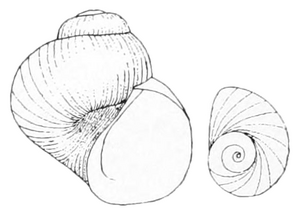
shell and operculum of extinct Clappia umbilicata
|
Endangered, threatened, and rare species
|
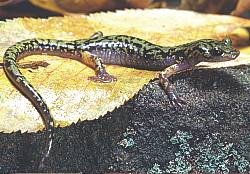
| Amphibians | There are 37 types of amphibians in the Coosa River Basin. Nine of these are of "Special Concern" in Georgia. | Endangered, threatened, and rare species
|
| Fish | There are 87 types of fish from 17 families. Thirteen of these fish species are protected by federal or state agencies.
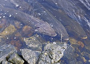
The lake sturgeon was common in the Coosa River until the 1960s. Now, the Georgia Department of Natural Resources is bringing them back.
The Alabama sturgeon used to live in the Coosa River below the Fall Line. It was listed as an endangered species in 2000. |
Endangered, threatened, rare and invasive species
|
| Mussels | Freshwater mussels help keep the water clean by filtering it. Georgia has 98 types of mussels, making it very diverse. Eleven types of mussels native to the Coosa basin are endangered or threatened. Thirteen species are now extinct. Alabama had one of the most diverse mussel populations in the world, with about 180 species. | Endangered, threatened, and rare species |
| Plants |
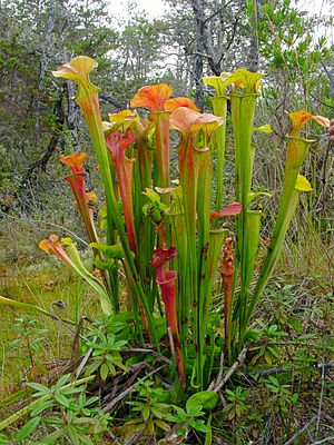
The upper Coosa watershed is home to most of the remaining green pitcherplant. This plant is endangered. |
Endangered, threatened, and rare species
|
| Reptiles | The southern hognose snake was once considered for protection. More research is needed to understand its current status. | Endangered, threatened, and rare species
|
| Birds and Mammals |
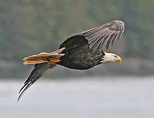
The bald eagle was once endangered, but now it nests near the Coosa River lakes. The largest group of the endangered red-cockaded woodpecker in Alabama lives near Lake Mitchell. Alabama Power helps protect them. |
Endangered, threatened, and rare species
|
Rivers and Streams that Feed the Coosa
The Coosa River's watershed has hundreds of smaller rivers and streams that flow into it. The main Coosa River starts in Georgia. It is formed when the Conasauga and Coosawattee Rivers join to create the Oostanaula River. The Oostanaula then meets the Etowah River in Rome, Georgia, and that's where the Coosa River officially begins.
Other important rivers and streams that flow into the Coosa include:
- Amicalola Creek
- Armuchee Creek
- Big Wills Creek
- Cartecay River
- Cedar Creek
- Chattooga River
- Chocolocco Creek
- Coahulla River
- Ellijay River
- Hatchett Creek
- Heath Creek
- Little River
- Mill Creek
- Mountain Creek
- Raccoon Creek
- Rock Creek
- Spring Creek
- Sugar Creek
- Terrapin Creek
- Waxahatchee Creek
- Weogufka Creek (through Hatchett Creek)
| Location | Tributaries |
|---|---|
| Rome, GA to Weiss Dam | Cedar Creek, Chattooga River, Spring Creek, Cowan River, Little River, Yellow Creek |
| Weiss Dam to H. Neely Henry Dam | Ballplay Creek, Cove Creek, Henley Creek, Canoe Creek, Permita Creek, Green's Creek, Beaver Creek, Ottery Creek, Shoal Creek |
| H. Neely Henry Dam to Logan Martin Dam | Cheaha Creek |
| Logan Martin Dam to Lay Dam | Kelly Creek, Talladega Creek, Tallaseehatchee Creek, Dry Branch, Bulley Creek, Beeswax Creek, Flat Branch, Cedar Creek, Sulphur Creek, Peckerwood Creek, Spring Creek, Blue Springs Creek, Reid Creek, Coaggie Creek, Waxahatchee Creek, Paint Creek |
| Lay Dam to Mitchell Dam | Clay Creek, Walnut Creek, Hatchet Creek, Pennymotley Creek, Weougufka Creek, Cargile Creek, Blue Creek |
| Mitchell Dam to Jordan Dam | Chesnut Creek, Shoals Creek, Weoka Creek, Sofkahatchee Creek |
| Jordan Dam to Confluence of Tallapoosa River | Corn Creek |
Cities Along the Coosa River
Several important cities are located along the Coosa River:
- Gadsden, Alabama - between Weiss and H. Neely Henry lakes
- Rainbow City, Alabama - south of Gadsden
- Childersburg, Alabama - near Lay Lake
- Rome, Georgia - where the river begins
- Southside, Alabama - south of Rainbow City
- Wetumpka, Alabama - near where the Coosa joins the Tallapoosa River
Groups Protecting the Coosa River
Several groups work to protect and improve the Coosa River:
- The Coosa-Alabama River Improvement Association was started in 1890. It works to promote the river's economic, recreational, and environmental benefits.
- The Alabama Rivers Alliance helps people in Alabama work together to protect clean and healthy waters.
- Alabama Water Watch trains volunteers to check the water quality in Alabama's rivers.
- The Alabama Power Foundation gives money for projects that help the environment and communities along the Coosa River.
- The Coosa River Basin Initiative is a group that helps people learn about the river. They want citizens to get involved in making the Coosa River Basin clean and healthy.
- Coosa Riverkeeper is a group of citizens who patrol the river, teach the public, and speak up for the river.
See also
 In Spanish: Río Coosa para niños
 | John T. Biggers |
 | Thomas Blackshear |
 | Mark Bradford |
 | Beverly Buchanan |


