
Southside, Alabama facts for kids
Quick facts for kids
Southside
|
|
|---|---|

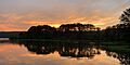
Sunset over the Coosa River in Southside
|
|
| Motto(s):
Rich in Hospitality and Genuine Southern Character, The Loveliest Village on the Coosa
|
|

Southside, Alabama
Location in Alabama

Southside, Alabama
Location in the United States
|
|
| Country | United States |
| State | Alabama |
| Counties | Etowah |
| Government | |
| • Type | Mayor-Council (5 members) |
| Area | |
| • Total | 19.27 sq mi (49.92 km2) |
| • Land | 19.11 sq mi (49.49 km2) |
| • Water | 0.17 sq mi (0.43 km2) |
| Elevation | 548 ft (167 m) |
| Population
(2020)
|
|
| • Total | 9,426 |
| • Density | 493.28/sq mi (190.45/km2) |
| Time zone | UTC-6 (Central (CST)) |
| • Summer (DST) | UTC-5 (CDT) |
| ZIP code |
35907
|
| Area code(s) | 256 |
| FIPS code | 01-71832 |
| GNIS feature ID | 2405499 |
Southside is a city in Etowah County, Alabama. It is part of the larger Gadsden Metropolitan Statistical Area. The city officially became a city in 1957. In 2010, about 8,412 people lived there. Southside is located about 8 to 12 miles south of downtown Gadsden.
Contents
Southside's Past: A Look at Its History
Southside began as a small farming area around 1850. It was formed when smaller communities like Green Valley, Cedar Bend, and Pilgrims Rest joined together. In the early days, most people in Southside earned their living through farming.
Green Valley was an important center for early businesses. It had a grist mill (for grinding grain), a blacksmith shop, and a sorghum mill (for making syrup). The area's cotton gin, which separated cotton fibers from seeds, was located near Brannon Springs and State Highway 77.
Geography: Where Southside Is Located
Southside is found in the southern part of Etowah County. It sits on the south side of the Coosa River. A small part of the city even stretches into Calhoun County to the south. The city is nestled in the lower hills of the southern Appalachian Mountains.
According to the U.S. Census Bureau, Southside covers a total area of about 19.19 square miles (49.6 square kilometers). Most of this area, about 19.00 square miles (49.2 square kilometers), is land. The rest, about 0.15 square miles (0.4 square kilometers), is water.
People of Southside: Population and Diversity
| Historical population | |||
|---|---|---|---|
| Census | Pop. | %± | |
| 1960 | 436 | — | |
| 1970 | 983 | 125.5% | |
| 1980 | 5,141 | 423.0% | |
| 1990 | 5,580 | 8.5% | |
| 2000 | 7,036 | 26.1% | |
| 2010 | 8,412 | 19.6% | |
| 2020 | 9,426 | 12.1% | |
| U.S. Decennial Census 2013 Estimate |
|||
Southside's Population in 2020
In 2020, the 2020 United States census counted 9,426 people living in Southside. There were 3,284 households and 2,314 families in the city.
| Race | Num. | Perc. |
|---|---|---|
| White (non-Hispanic) | 8,525 | 90.44% |
| Black or African American (non-Hispanic) | 221 | 2.34% |
| Native American | 30 | 0.32% |
| Asian | 74 | 0.79% |
| Other/Mixed | 371 | 3.94% |
| Hispanic or Latino | 205 | 2.17% |
Southside's Population in 2010
The 2010 United States Census showed that 8,412 people lived in Southside. There were 3,228 households and 2,524 families. The city had about 440 people per square mile. There were 3,500 housing units, with about 183 units per square mile.
Most of the people in Southside were White (96.54%). Other groups included Black or African American (1.46%), Native American (0.18%), and Asian (0.67%). About 1.27% of the population was Hispanic or Latino.
In 2010, 35.9% of households had children under 18. About 65.86% were married couples living together. The average household had 2.58 people, and the average family had 2.94 people.
The median age in Southside was 40.1 years. About 26.9% of the population was 19 years old or younger. About 13.4% were 65 years or older.
In 2000, the average income for a household in Southside was $52,464. For a family, it was $58,427. The average income per person was $21,936. About 3.6% of the population lived below the poverty line. This included 3.1% of those under 18.
Education: Schools in Southside
The schools in Southside are managed by the Etowah County Board of Education. The city has one elementary school and one high school. It also shares a middle school with the nearby city of Rainbow City. Students in Southside can also choose to attend schools in the Gadsden City school system if they prefer.
- Southside Elementary School
- Southside High School
- Rainbow Middle School
Images for kids
-
Sunset over the Coosa River in Southside
See also
 In Spanish: Southside (Alabama) para niños
