
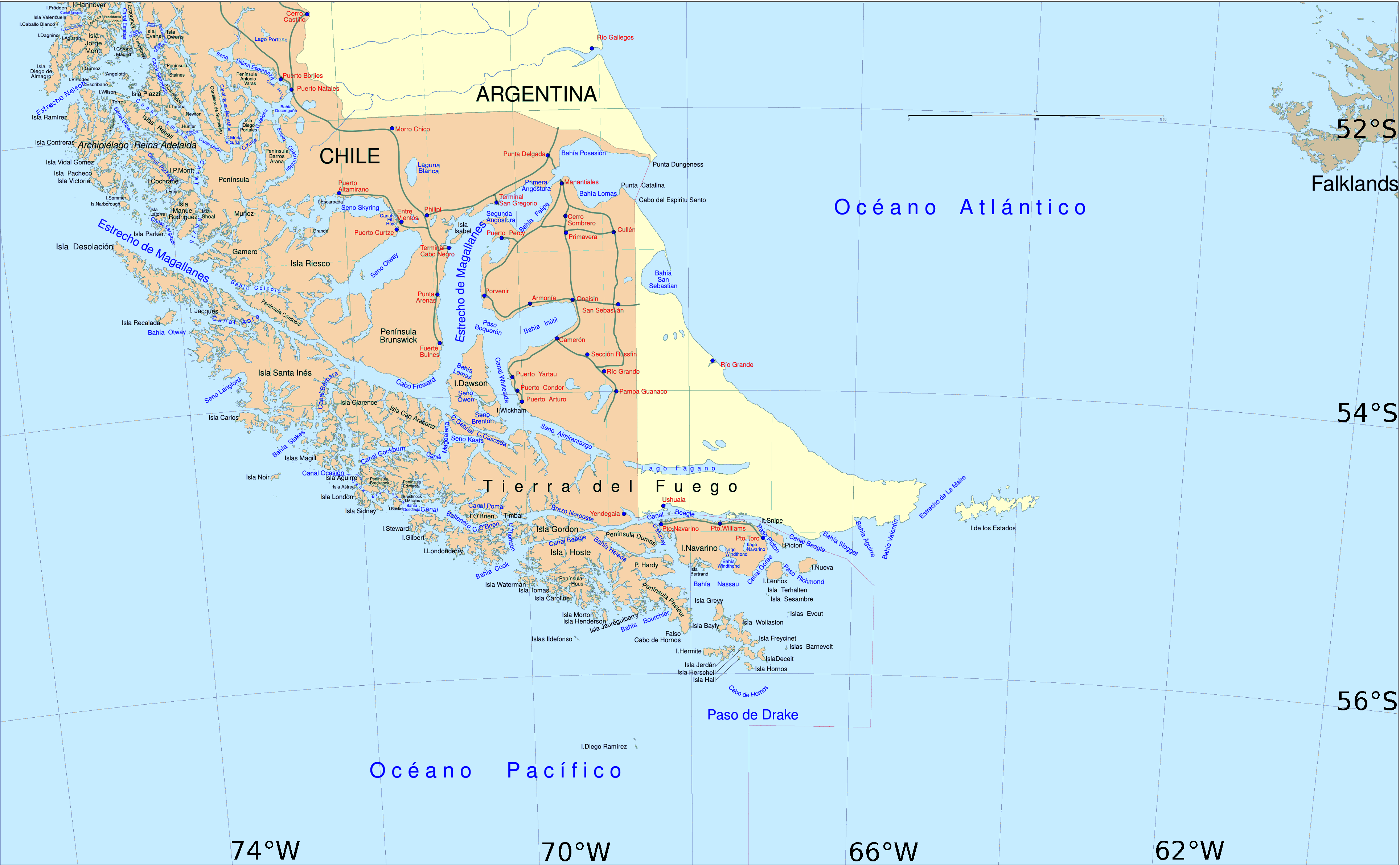
Image: South America southern tip pol
Description: Political map of southern Chile and Argentina, from Straits of Magellan to Cape Horn.
Title: South America southern tip pol
Credit: File:Sur2.gif
Author: User:Createaccount
Permission: The map has been created with the Generic Mapping Tools: http://gmt.soest.hawaii.edu/ using one or more of these public-domain datasets for the relief: ETOPO2 (topography/bathymetry): http://www.ngdc.noaa.gov/mgg/global/global.html GLOBE (topography): http://www.ngdc.noaa.gov/mgg/topo/gltiles.html SRTM (topography): http://www2.jpl.nasa.gov/srtm/ বাংলা | English | Français | Italiano | 日本語 | Македонски | +/− Permission is granted to copy, distribute and/or modify this document under the terms of the GNU Free Documentation License, Version 1.2 or any later version published by the Free Software Foundation; with no Invariant Sections, no Front-Cover Texts, and no Back-Cover Texts. A copy of the license is included in the section entitled GNU Free Documentation License.http://www.gnu.org/copyleft/fdl.htmlGFDLGNU Free Documentation Licensetruetrue
Usage Terms: Creative Commons Attribution-Share Alike 3.0
License: CC-BY-SA-3.0
License Link: http://creativecommons.org/licenses/by-sa/3.0/
Attribution Required?: Yes
Image usage
The following 17 pages link to this image:
