Inchtavannach facts for kids
| Gaelic name | Innis Taigh a' Mhanaich |
|---|---|
| Meaning of name | island of the monk's house |
| OS grid reference | NS365915 |
| Coordinates | 56°05′N 4°38′W / 56.08°N 4.63°W |
| Physical geography | |
| Island group | Loch Lomond |
| Area | 70 ha |
| Area rank | 174= (Freshwater: 4) |
| Highest elevation | Tom na Clag 84 m |
| Administration | |
| Sovereign state | United Kingdom |
| Country | Scotland |
| Council area | Argyll and Bute |
| Demographics | |
| Population | 3 |
Inchtavannach is a beautiful island located in Loch Lomond, one of Scotland's most famous lochs. Its name comes from the Scottish Gaelic Innis Taigh a' Mhanaich, which means 'Island of the Monk's House'. This island is known for its natural beauty and interesting history.
Exploring Inchtavannach's Geography
Inchtavannach sits across from a small village called Aldochlay. A part of the water known as Bandry Bay separates the island from the mainland. This bay is just south of the village of Luss.
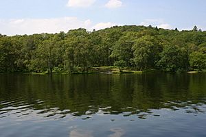
The island itself is quite hilly and tall. It is mostly covered with natural oak trees, making it a very green place. The highest point on the island is called Tom nan Clag, which means 'Mound of the Bell'. This northern peak rises steeply to about 86 meters (282 feet) high. It is the highest point on any island in Loch Lomond. There is also a southern peak that reaches about 55 meters (180 feet) high.
A Glimpse into Inchtavannach's History
Inchtavannach has a long and fascinating history. It is believed that a very important person named St Kessog was killed here a long time ago.
The island was once home to a monastery. A monastery is a place where monks live and pray. This is why the island's name means 'Monk's Isle'. Since 1760, a large house has stood where the old monastery used to be. It is said that the monks would ring a bell on the island to call everyone to prayer.
Wild Roe Deer have also lived on Inchtavannach. In the 17th century, a man named Sir James Colquhoun built a winding path up to the island's highest point. This path allowed people to explore the beautiful views.
Famous poets Samuel Taylor Coleridge and William Wordsworth visited the island in August 1803. Wordsworth's sister, Dorothy, also came with them. More recently, Brian Mahoney, who produced the TV show Take the High Road, lived in a house on the island for ten years.
 | Calvin Brent |
 | Walter T. Bailey |
 | Martha Cassell Thompson |
 | Alberta Jeannette Cassell |


