Independence, Indiana facts for kids
Quick facts for kids
Independence, Indiana
|
|
|---|---|

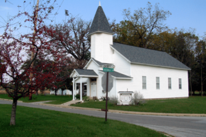
The intersection of Independence and Cicott Roads
|
|
| Country | United States |
| State | Indiana |
| County | Warren |
| Township | Warren |
| Founded | 1832 |
| Founded by | Zachariah Cicott |
| Area | |
| • Total | 0.21 sq mi (0.54 km2) |
| • Land | 0.19 sq mi (0.49 km2) |
| • Water | 0.02 sq mi (0.05 km2) |
| Elevation | 558 ft (170 m) |
| Population
(2020)
|
|
| • Total | 79 |
| • Density | 417.99/sq mi (161.66/km2) |
| Time zone | UTC-5 (Eastern (EST)) |
| • Summer (DST) | UTC-4 (EDT) |
| ZIP code |
47993
|
| Area code(s) | 765 |
| GNIS feature ID | 2806502 |
Independence is a small, quiet community in Warren Township, Warren County, in the U.S. state of Indiana. It is known as an unincorporated community, which means it's not officially a city or town with its own local government.
A Look at Its Past
Long ago, even before Independence was officially a community, there was a trading post here in 1811. A trading post was a place where people could trade goods, often with Native Americans.
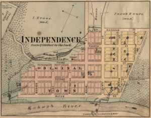
The community of Independence was officially started on October 5, 1832. It was planned out by a man named Zachariah Cicott. He was a French-Indian trader and also worked as a scout for General William Henry Harrison. Cicott received this land from the government because of his services.
A post office opened in Independence on March 24, 1834. It served the community for many years but eventually closed on January 31, 1950. Today, people in Independence get their mail from the post office in nearby Attica. Even though Attica is in a different county, it's the closest post office for Independence residents.
Independence was also home to the very first newspaper in Warren County. It was called the Wabash Register and started in 1844. Enos Canutt was the person who ran this newspaper.
Where is Independence?
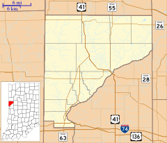
Independence is located in the eastern part of Warren County. It sits on the western banks of the Wabash River. This river is an important waterway in Indiana.
The community is about 7 miles (11 km) northeast of Williamsport, which is the main town and county seat of Warren County. A county seat is like the capital of a county, where the main government offices are located.
On the opposite side of the Wabash River, in Fountain County, you'll find the small community of Riverside.
Who Lives Here?
| Historical population | |||
|---|---|---|---|
| Census | Pop. | %± | |
| 2020 | 79 | — | |
| U.S. Decennial Census | |||
Demographics is a word that describes information about the people who live in a place, like how many there are. According to the 2020 United States Census, 79 people lived in Independence. This shows it's a very small community.
See also
 In Spanish: Independence (Indiana) para niños


