Attica, Indiana facts for kids
Quick facts for kids
Attica
|
|
|---|---|

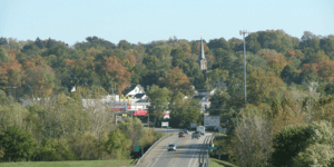
Looking into Attica across the Wabash
|
|
| Nickname(s):
Johnson I.N
|
|

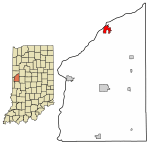
Location of Attica in Fountain County, Indiana.
|
|
| Country | United States |
| State | Indiana |
| County | Fountain |
| Township | Logan |
| Area | |
| • Total | 1.80 sq mi (4.67 km2) |
| • Land | 1.80 sq mi (4.67 km2) |
| • Water | 0.00 sq mi (0.00 km2) |
| Elevation | 640 ft (200 m) |
| Population
(2020)
|
|
| • Total | 3,036 |
| • Density | 1,682.93/sq mi (649.85/km2) |
| Time zone | UTC-5 (EST) |
| • Summer (DST) | UTC-4 (EDT) |
| ZIP code |
47918
|
| Area code | 765 |
| FIPS code | 18-02620 |
| GNIS ID | 2394018 |
Attica is a city in Logan Township, Fountain County, Indiana, United States. It is a friendly community located right by the Wabash River.
Contents
History of Attica
Attica was first planned out by George Hollingsworth and David Stump in 1825. A "plat" is like a map that shows how land is divided into lots for building.
Growth and the Wabash and Erie Canal
A big change happened in 1847 when the Wabash and Erie Canal was finished through Attica. This canal was like a superhighway for boats. It helped Attica grow a lot and become more important than nearby towns like Rob Roy and Williamsport.
Music and Historic Places
Attica is close to where Paul Dresser is thought to have written Indiana's state song, "On the Banks of the Wabash, Far Away" in 1897. The bridge over the Wabash River in Attica is even named after him!
Over time, Attica grew to include smaller communities nearby. One of these was called Vine. Today, you can find where Vine used to be by looking for the end of North Vine School Road.
Attica has many old and important buildings. Several areas, like the Attica Downtown Historic District, are listed on the National Register of Historic Places. This means they are special places that are protected because of their history.
Geography of Attica
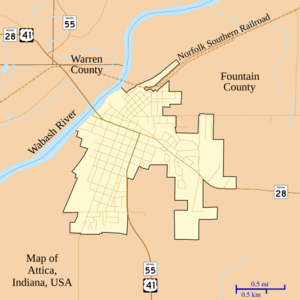
Attica is located along the Wabash River. Important roads like U.S. Route 41, State Road 28, and State Road 55 all meet in Attica.
The city covers about 1.6 square miles (4.1 square kilometers) of land.
People of Attica
| Historical population | |||
|---|---|---|---|
| Census | Pop. | %± | |
| 1860 | 1,713 | — | |
| 1870 | 2,273 | 32.7% | |
| 1880 | 2,150 | −5.4% | |
| 1890 | 2,320 | 7.9% | |
| 1900 | 3,005 | 29.5% | |
| 1910 | 3,335 | 11.0% | |
| 1920 | 3,392 | 1.7% | |
| 1930 | 3,700 | 9.1% | |
| 1940 | 3,760 | 1.6% | |
| 1950 | 3,862 | 2.7% | |
| 1960 | 4,341 | 12.4% | |
| 1970 | 4,262 | −1.8% | |
| 1980 | 3,841 | −9.9% | |
| 1990 | 3,457 | −10.0% | |
| 2000 | 3,491 | 1.0% | |
| 2010 | 3,245 | −7.0% | |
| 2020 | 3,036 | −6.4% | |
| U.S. Decennial Census | |||
In 2010, there were 3,245 people living in Attica. These people lived in 1,308 households. About 32% of these households had children under 18 living there. The average household had about 2.45 people.
Most people in Attica are white (97.8%). A small number of people are from other backgrounds, including Asian, American Indian, or African American. About 2.4% of the population was of Hispanic or Latino origin. Many families in Attica have German, English, or Irish roots.
Education in Attica
Attica has a public library called the Attica Public Library. It offers free books and resources for everyone in the city.
Notable People from Attica
- George Dewey Hay: He was the person who started the famous country music show, the Grand Ole Opry. He was honored for his contributions in 1988.
See also
 In Spanish: Attica (Indiana) para niños
 | Toni Morrison |
 | Barack Obama |
 | Martin Luther King Jr. |
 | Ralph Bunche |


