Indian River (Manistique River tributary) facts for kids
Quick facts for kids Indian River |
|
|---|---|
 |
|
| Country | United States |
| Physical characteristics | |
| Main source | Au Train Township, Alger County, Michigan |
| River mouth | Manistique River near Manistique, Schoolcraft County, Michigan 600 feet (180 m) |
| Type: | Scenic, Recreational |
| Designated: | March 3, 1992 |
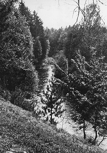
The Indian River is a river in the Upper Peninsula of Michigan, United States. It flows for about 59 miles (95 km). This river is a branch, or tributary, of the Manistique River.
Contents
About the Indian River
The Indian River starts from Hovey Lake. This lake is located in Alger County. The river then flows south and east. It passes through many small lakes. It also flows through Schoolcraft County.
Where the River Flows
The river flows into a large body of water called Indian Lake. This lake covers about 8,659 acres (35 square kilometers). After leaving Indian Lake, the river flows east and south. It travels about 2.5 miles (4 km) more. Then, it joins with the Manistique River. The Manistique River continues through Manistique. Finally, it empties into Lake Michigan.
Smaller Rivers Joining In
Several smaller rivers and creeks flow into the Indian River. These are called tributaries.
- The Little Indian River
- Murphy Creek
- Big Murphy Creek
- Smith Creek
A Special River: Wild and Scenic
The Indian River is part of the National Wild and Scenic Rivers System. This means it is a special river. It is protected for its natural beauty and importance.
What "Wild and Scenic" Means
A river can be called "Wild," "Scenic," or "Recreational."
- About 12 miles (19 km) of the Indian River are "Scenic." This means the area around it is mostly natural. It has beautiful landscapes.
- About 39 miles (63 km) are "Recreational." This part is also natural. But it might have more access points. It is good for fun activities.
Exploring the River: Paddling
The Indian River is a popular spot for people who like to paddle. You can use canoes or kayaks here.
Challenges for Paddlers
Some parts of the river are harder to paddle.
- The section from Hovey Lake to Doe Lake is not kept clear. Paddlers often need to carry their boats. This is called a portage.
- From Doe Lake to Indian Lake, the forest service sometimes clears the path. However, you might still find fallen trees. This means you may still need to portage your boat.
 | May Edward Chinn |
 | Rebecca Cole |
 | Alexa Canady |
 | Dorothy Lavinia Brown |

