Invergowrie, New South Wales facts for kids
Quick facts for kids InvergowrieNew South Wales |
|
|---|---|

Invergowrie
|
|
| Population | 775 (2016 census) |
| Postcode(s) | 2350 |
| Elevation | 1,040 m (3,412 ft) |
| Location |
|
| LGA(s) | Uralla Shire |
| County | Sandon |
| State electorate(s) | Northern Tablelands |
| Federal Division(s) | New England |
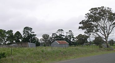
Invergowrie is a small place, or locality, in the Uralla Shire area of New South Wales, Australia. It's located in a region called the Northern Tablelands. Invergowrie is about 16 kilometres (10 miles) west of a bigger town called Armidale. It sits roughly halfway between the major cities of Sydney and Brisbane. It is also about 200 kilometres (124 miles) inland from Coffs Harbour on the Pacific coast.
About Invergowrie
Invergowrie is a popular rural neighbourhood. Many people who work at the University of New England live here. In 2016, a count showed that 775 people lived in Invergowrie.
What's in Invergowrie?
Even though it's a small place, Invergowrie has some useful services. You can find a general store there. There is also a fuel station for cars. The community also has a New South Wales Rural Fire Service station. This station helps keep everyone safe from fires.
Where Did the Name Come From?
The name Invergowrie comes from a village in Scotland. It was named after the village of Invergowrie in Scotland.


