Irrara County facts for kids
Quick facts for kids IrraraNew South Wales |
|||||||||||||||
|---|---|---|---|---|---|---|---|---|---|---|---|---|---|---|---|

Location in New South Wales
|
|||||||||||||||
|
|||||||||||||||
Irrara County is a special area of land in New South Wales, Australia. It is one of 141 such areas called cadastral divisions. Think of it like a very old way of dividing up land for maps and records.
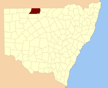
This county is located in the western part of New South Wales. You can find it south of the border with Queensland. It sits between two important rivers: the Paroo River to the west and the Warrego River to the east.
Contents
Exploring Irrara County's Location
Irrara County is a large area, but it does not have any big towns. Instead, you will find small communities called Yantabulla and Fords Bridge. These are the only places where people live in small groups within the county.
Nearby Places and Borders
Even though Irrara County is mostly open land, there are some towns just outside its borders. To the northeast, you will find Barringun, Queensland. In the northwest, there is Hungerford, Queensland. To the south, close to the county's edge, are Enngonia, New South Wales and Waanaring, New South Wales.
The Meaning Behind the Name Irrara
The name "Irrara" has a special history. It is believed to come from a word used by the local Aboriginal people. This shows the deep connection the land has to its original inhabitants.
Future Solar Eclipse Sightings
Something exciting might happen in Yantabulla, one of the small communities in Irrara County. It is known as a future spot for a rare event: seeing two solar eclipses close together! A solar eclipse happens when the Moon passes between the Sun and Earth, blocking the Sun's light. Seeing two in a short time is very unusual and special.


