Paroo River facts for kids
Quick facts for kids Paroo |
|
|---|---|

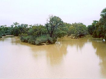
Paroo River at Wanaaring, New South Wales
|
|
|
Location of the Paroo River mouth in New South Wales
|
|
| Other name(s) | Paroo Channel, Paroo River Channels |
| Country | Australia |
| States | Queensland, New South Wales |
| Region | South West Queensland, Far West, New South Wales |
| Physical characteristics | |
| Main source | Mariala National Park west of Augathella, Queensland 336 m (1,102 ft) 26°07′56″S 145°10′39″E / 26.13222°S 145.17750°E |
| River mouth | confluence with the Darling River in wetter seasons north of White Cliffs, New South Wales 94 m (308 ft) 31°33′30″S 143°27′08″E / 31.55833°S 143.45222°E |
| Length | 1,210 km (750 mi) |
| Basin features | |
| River system | Darling River catchment, Murray–Darling basin |
| Basin size | 60,095 km2 (23,203 sq mi) |
| Reservoirs | Buckenby Waterhole, Humeburn Waterhole, Corni Paroo Waterhole, Caiwarro Waterhole, Thoulcanna Dam, Talyealye Billabong and Budtha Waterhole |
The Paroo River is a special river in Australia. It flows through the south-west part of Queensland and the Far West of New South Wales. This river is made up of many waterholes that connect during wet weather. When it rains a lot, these waterholes join to form a running stream. The Paroo River is part of the larger Darling River system, which is itself part of the huge Murray–Darling basin. This area has been home to the Paarkantji people for a very long time.
Contents
Journey of the Paroo River
The Paroo River starts in the rocky gorge country of western Queensland. This is south of the Mariala National Park. From there, it flows generally southwards. As it travels, it spreads out into the wide, flat lands of New South Wales.
The river usually ends in a group of lakes called the Paroo overflow lakes. Most of the time, the river stops flowing south of Wanaaring. It only reaches the Darling River during very wet years. Otherwise, its waters spread into the important Paroo River Wetlands.
The Paroo River is about 1,210-kilometre (750 mi) long. Along its journey, it drops about 242 metres (794 ft) in height. Forty-three smaller streams and creeks join the Paroo River as it flows.
Natural Waterholes and Dams
The Paroo River is special because it is the last major river in the northern Murray–Darling basin that still flows freely. This means its flow is not stopped by big human-made dams. Instead, it has natural waterholes and a few small dams that hold its water.
These natural waterholes include Buckenby Waterhole, Humeburn Waterhole, Corni Paroo Waterhole, Caiwarro Waterhole, Talyealye Billabong, and Budtha Waterhole. There is also a small dam called Thoulcanna Dam.
Important Wetlands
The Paroo River has amazing wetlands in north-western New South Wales. These wetlands are very important for many animals, especially birds. They provide a safe home for birds like the freckled duck and the Australian painted snipe. These birds are considered threatened, meaning their numbers are getting low.
The wetlands are part of a larger area called the Paroo Floodplain and Currawinya Important Bird Area. This area is recognized by BirdLife International because it's a crucial spot for many waterbirds when conditions are right.
In 2007, the Paroo River Wetlands were listed under the Ramsar Convention. This means they are recognized as wetlands of international importance. This makes them Australia's 65th Ramsar site. This special listing helps protect these valuable natural areas.
Images for kids
See also
 In Spanish: Río Paroo para niños
 | Percy Lavon Julian |
 | Katherine Johnson |
 | George Washington Carver |
 | Annie Easley |


