
Isla de Cabras facts for kids

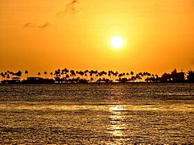
Isla de Cabras from El Morro
|
|

Isla de Cabras
Location in Puerto Rico

Isla de Cabras
Location in Lesser Antilles

Isla de Cabras
Location in Caribbean
|
|
| Geography | |
|---|---|
| Location | San Juan bay, Puerto Rico |
| Coordinates | 18°28′20.51″N 66°8′12.3″W / 18.4723639°N 66.136750°W |
| Administration | |
| Commonwealth | Puerto Rico |
| Municipality | Toa Baja |
| Barrio | Palo Seco |
Isla de Cabras means "Goat Island" in Spanish. It is a small island located right at the entrance of San Juan Bay in Puerto Rico. This islet is part of the Palo Seco area within the town of Toa Baja.
Today, Isla de Cabras is home to a few important places:
- Fortín San Juan de la Cruz, also known as El Cañuelo.
- A fun recreational park that recently opened.
- A training area for the local police.
This island has been used for many different purposes throughout its history.
Contents
Island History
Spanish Fort Defenses
Isla de Cabras was a very important spot because it sat right at the entrance of San Juan Bay. From here, soldiers could work with Fort San Felipe del Morro (El Morro) to create a strong defense. They could fire cannons from both sides to stop enemy ships from entering the bay. It also helped protect the entrance of the Bayamón River nearby.
A Place for Healing

In the late 1800s, a special place was set up on the island for people with a certain illness. On December 17, 1876, the governor of Puerto Rico, Segundo de la Portilla, laid the first stone for a new building. This building was finished in 1883 and was meant to house those needing care. However, it's thought that people were living there even before the building was completed.
When American troops arrived in Puerto Rico in 1898, the island's government took over the building's management. Records from the 1910 US Census show that 35 people were living on the island at that time.
In 1926, a new facility was built on the main island in Trujillo Alto. The people living on Isla de Cabras were then moved to this new, larger place. Even though it's no longer used for its original purpose, the old building still stands on Isla de Cabras today.
American Military Base
In the 1940s, the United States built Fort Amezquita on Isla de Cabras. It was named after Juan de Amézqueta. This fort was very close to El Cañuelo. At first, it was called the "Cabras Island Military Reservation."
During World War II, Fort Amezquita served as a strong "concrete gun battery" for the US Army Coast Artillery Corps. In November 1940, the U.S. Army brought three large 12-inch coastal guns from another fort. Two of these guns were set up at Fort Amezquita as "Battery Reed." They were placed on special mounts and protected by concrete walls.
Fun Park and Training Area
More recently, the land that used to be Fort Amezquita was turned into a shooting range and training area. This area is now used by the P.R.P.D..
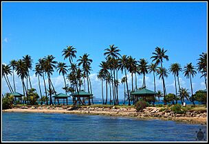
The ownership of the rest of the island's land was debated for a while. Eventually, it was given to the Department of Sports and Recreation. This led to the opening of the Isla de Cabras Recreational Park. The park has several picnic areas (gazebos) and a beach where people can swim and fish.
Gallery
Places and views of Isla de Cabras:
-
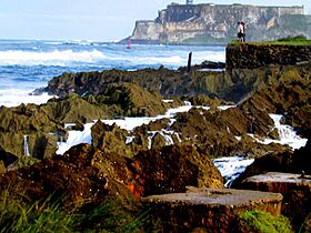
Isla de Cabras with El Morro in the background
-
-
-
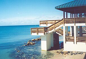
One of the main gazebos at Isla de Cabras Recreational Park (2005)
-
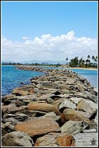
Isla de Cabras
-
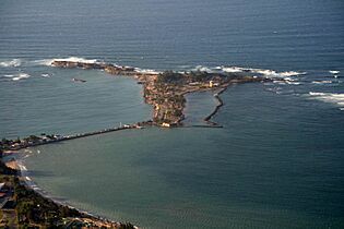
Aerial view of Isla de Cabras


See also
 In Spanish: Isla de Cabras para niños
