
Toa Baja, Puerto Rico facts for kids
Quick facts for kids
Toa Baja
Municipio Autónomo de Toa Baja
|
|||
|---|---|---|---|
|
Town and Municipality
|
|||

Punta Salinas Beach in Toa Baja
|
|||
|
|||
| Nicknames:
Ciudad de los Valles del Toa,
Ciudad Bajo Aguas, Los Llaneros |
|||
| Anthem: "Mi Pueblo Es Toa Baja" | |||

Map of Puerto Rico highlighting Toa Baja Municipality
|
|||
| Sovereign state | |||
| Commonwealth | |||
| Settled | 1745 | ||
| Founded | January 18, 1784 | ||
| Barrios | |||
| Area | |||
| • Total | 41.7 sq mi (108.0 km2) | ||
| • Land | 23.16 sq mi (59.99 km2) | ||
| • Water | 18.54 sq mi (48.01 km2) | ||
| Population
(2020)
|
|||
| • Total | 75,243 | ||
| • Rank | 8th in Puerto Rico | ||
| • Density | 1,804.4/sq mi (696.7/km2) | ||
| Demonym(s) | Toabajeños | ||
| Time zone | UTC−4 (AST) | ||
| ZIP Codes |
00949, 00950, 00951, 00952
|
||
| Area code(s) | 787/939 | ||
| Major routes | |||


Toa Baja (pronounced toe-ah BAH-hah) is a town and municipality located on the northern coast of Puerto Rico. It is situated north of Toa Alta and Bayamón, east of Dorado, and west of Cataño. Toa Baja is divided into five main areas called barrios, including Toa Baja Pueblo, which is the main downtown and administrative center. This town is part of the larger San Juan-Caguas-Guaynabo Metropolitan Statistical Area. It's about a 15-minute drive from San Juan.
Contents
History of Toa Baja
Early Settlements and Spanish Arrival
The area that is now Toa Baja was once home to the Taíno people, who were the native inhabitants of Puerto Rico. Their regions were called Toa and Bayamón, led by chiefs named Aramana and Majagua. When the Spanish arrived, they started a farm around 1511. Here, Spanish settlers learned from the Taínos how to grow different fruits and vegetables. Some of the first families to settle here came from the Canary Islands.

In 1745, Toa Baja officially became a town. A church dedicated to Nuestra Señora de la Concepción (Our Lady of the Immaculate Conception) was built in 1749. By 1776, the area had many cattle farms and sugar cane estates. However, the nearby rivers often flooded, causing problems for the people. Because of the flooding, some residents moved and helped found the nearby municipality of Dorado in 1842.
Changes in Control and Population Growth
After the Spanish–American War, Spain gave Puerto Rico to the United States in 1898. The first census by the United States in 1899 showed Toa Baja had a population of 4,030 people.
In 1902, the government of Puerto Rico decided to combine several municipalities. Toa Baja became part of Bayamón. But this change didn't last long. In 1905, the law was canceled, and Toa Baja became an independent town again. By 2010, Toa Baja's population had grown significantly to 89,609 residents, making it one of the most populated municipalities in Puerto Rico.
Hurricane Maria and Flood Control Efforts
On September 20, 2017, Hurricane Maria caused the La Plata River to rise more than 11 feet. This led to a lot of damage in Toa Baja. One of the four radar systems used by the Federal Aviation Administration in Puerto Rico is located at Punta Salinas in Toa Baja. These systems were damaged by the hurricane and took almost two weeks to fix.

To help prevent future damage, the United States Army Corps of Engineers started a big flood control project in 2018 for the Río de la Plata river. This project aims to reduce the frequent flooding in Toa Baja.
Geography and Environment
Location and Landscape
Toa Baja is located in the Northern Coastal Plains of Puerto Rico. Its land covers about 24 square miles (62.4 square kilometers). The ground is mostly made of alluvial deposits and clay from the surrounding waters.
The land's height ranges from 200 to 490 feet (60 to 150 meters) above sea level. The highest parts are in the south, while the rest of the area is mostly flat. The northern part of Toa Baja has many mangroves and marshes. The southern part is known for its karst landscape, which has unique rock formations.
Rivers and Waterways
Toa Baja has three main rivers: Río de la Plata, Río Cocal, and Río Hondo. The La Plata River is the longest river in Puerto Rico and flows through the eastern part of Toa Baja. The Cocal River forms the natural border between Toa Baja and Dorado. There is also a bay called Boca Vieja Bay (Spanish: Ensenada Boca Vieja) in Toa Baja.
Flood Zones and Community Safety
New maps from 2019 show that Toa Baja is very likely to experience flooding. This is because many rivers run through the municipality, placing almost the entire area in a flood zone. Historically, homes in Toa Baja were built a few feet above the ground to prepare for floods. After Hurricane Maria, architects from the University of Puerto Rico and Polytechnic University of Puerto Rico gave ideas to residents on how to build safer homes to reduce flood risks.
Barrios and Communities

Like all municipalities in Puerto Rico, Toa Baja is divided into smaller areas called barrios. The main town area, with municipal buildings and the central church, is called "el pueblo". The five official barrios are:
Even though it's not an official barrio, Levittown is the most populated community within Toa Baja. Barrios are further divided into even smaller areas called sectores (sectors). These can be different types, like urbanización (urbanization) or barriada (neighborhood).
Toa Baja also has "Special Communities" (Comunidades Especiales de Puerto Rico). These are areas where people might face challenges like social exclusion. In 2014, some of these communities in Toa Baja included Sector Villa Hostos, San José, and Villa del Sol.
Population and Demographics
Toa Baja's population has changed over the years. In 1899, there were 4,030 people. The population steadily grew, reaching 94,085 in 2000. By 2010, it was 89,609, and in 2020, the population was 75,293. This shows a decrease of about 16% since 2010.
Tourism and Attractions
Toa Baja has 22 beaches, offering many places to visit.
Popular Landmarks and Places
.jpg)
Some of the main attractions in Toa Baja include:
- Cañuelo Fortress
- Central Constancia (an old sugar mill)
- Isla de Cabras
- Hacienda Santa Elena
- Hermana Island
- Nuestra Señora del Carmen Church
- Palo Seco Thermoelectrical Power Station
- Punta Salinas Beach
- San Pedro Apostle Church
- Coliseo Antonio R. Barceló (a sports arena)
Culture and Events
Festivals and Celebrations
Toa Baja celebrates its patron saint festival in June. This event, called Fiestas Patronales de San Pedro Apostol, honors Saint Peter. It's a religious and cultural celebration with parades, games, local crafts, amusement rides, traditional food, and live music.
In May, the town celebrates the Fiestas de la Santa Cruz (Festival of the Holy Cross). This festival lasts for nine nights and involves various churches and cultural groups.
October brings the Festival de la Zafra, which celebrates the sugar cane harvest. It features musical groups playing traditional bomba and plena music.
Other festivals and events in Toa Baja include:
- Artisans Festival (Feria de Artesanías) – March
- Beach Festival – July
- Musical Bands Festival – August
- Christmas Festival – December
Sports in Toa Baja
While Toa Baja doesn't have teams in the main male sports leagues on the island, it does have a female volleyball team called the Llaneras de Toa Baja in the Liga de Voleibol Superior Femenino.
Each year, Toa Baja hosts two major youth baseball events: the Pee Wee Reese World Series for players aged 12 and under, and the Willie Mays World Series for players aged 10 and under. The town has a baseball team called the Llaneros de Levittown that competes in the Pee Wee Reese category.
Economy and Industry
For many years, Toa Baja's economy was based on agriculture, especially sugar cane and cattle farming. Important haciendas (large estates) like Hacienda Santa Elena and Central Constancia were located here. Fishing also became a key part of the economy in the mid-18th century. The cattle farms in Toa Baja were known for producing a lot of milk. Growing small fruits also remains an important product for the area.
After the 1950s, manufacturing started to take over from agriculture as the main economic activity. Today, the industrial sector is still very important for the region's economic growth. Toa Baja manufactures products such as metal, plastic, concrete, textiles, electrical and electronic machinery, and rum.
Symbols of Toa Baja
The municipality of Toa Baja has its own official flag and coat of arms.
Toa Baja Flag
Toa Baja's flag has two vertical bands. The left side is green, and the right side is gold. The green band represents the plains of the Toa River, which is now known as La Plata River. The golden band symbolizes the sun. On the green band, there are two keys, one gold and one silver, crossed over each other. These keys represent Saint Peter, who is the patron saint of the city.
Toa Baja Coat of Arms
The coat of arms for Toa Baja features a green wavy stripe. This stripe stands for the Toa River, one of the first rivers mentioned in Puerto Rico's history. Like the flag, it also has two crossed keys, symbolizing Saint Peter, the town's patron saint. On each side of the keys, there are the letters "F" and "J". These letters represent Ferdinand II of Aragon and his daughter, Joanna of Castile, who were important rulers of Spain.
The gold areas above and below the green stripe show the wealth of the city. The coat of arms also includes bunches of yucca, which was one of the main crops grown in this area. Yucca is a symbol of the Taíno people, who grew it and used it to make their main food, cassava bread. Two sugar cane stems surround the shield, representing the cultivation and industry of sugar cane, which was the main source of Toa Baja's economy for a long time.
Transportation in Toa Baja
Toa Baja is about 25 minutes by car from San Juan during times without heavy traffic. However, during rush hour, it can take up to 90 minutes. The main roads to the city are PR-22 and PR-165.
A new bus rapid transit (BRT) system called Metro Urbano operates in the middle of the José de Diego Expressway (PR-22). These buses use special lanes for high-occupancy vehicle lanes (HOV) and travel from Candelaria in Toa Baja to the Bayamón Station of the Tren Urbano metro system. There are 29 bridges in Toa Baja.
Notable People from Toa Baja
- Susana Centeno, a nurse
- Edwin Rosario (1963–1997) - a professional boxer and four-time world champion. He was added to the IBHOF (International Boxing Hall of Fame) in 2006.
- Madison Anderson - Miss Universe Puerto Rico 2019 and the first runner-up in Miss Universe 2019.
Images for kids
-
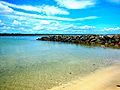
Beach in Sabana Seca barrio

See also
 In Spanish: Toa Baja para niños
