Islip Saddle facts for kids
Quick facts for kids Islip Saddle |
|
|---|---|

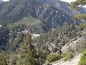
Islip Saddle from the Mount Williamson Trail
|
|
| Elevation | 6,680 ft (2,036 m) |
| Traversed by | |
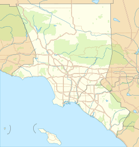
| Location | Los Angeles County, California |
| Range | San Gabriel Mountains |
| Coordinates | 34°21.40′N 117°51.06′W / 34.35667°N 117.85100°W |
Islip Saddle is a special spot high up in the San Gabriel Mountains in Los Angeles County, California. It's like a low point between two higher areas, making it a "saddle" in the mountains. This saddle is also a mountain pass, which means it's a place where roads can cross over the mountains.
It sits just west of a peak called Mount Islip. Two important roads meet here: State Route 2 and State Route 39. Islip Saddle is the second highest mountain pass on State Route 2.
Contents
What is Islip Saddle?
Islip Saddle is a mountain pass located in the San Gabriel Mountains. A "saddle" in geography means a low point between two higher peaks. Think of it like the saddle on a horse's back.
This area is a key meeting point for two state highways. It's also a popular starting place for hikers and nature lovers.
Where is Islip Saddle located?
Islip Saddle is found in Los Angeles County, California. It's nestled between Mount Williamson to the northwest and Mount Islip to the southeast. This location is at the very top of San Gabriel Canyon.
Why is it called Islip Saddle?
The name Islip Saddle comes from a person named George Islip. He was a homesteader from Canada. George Islip lived in the nearby San Gabriel Canyon in the early 1900s. The area was named in his honor.
Exploring Islip Saddle
When you visit Islip Saddle, you'll find a parking lot. There are also public restrooms available for visitors. These facilities are helpful for people planning to hike in the area.
During winter, heavy snow can close parts of the highway. A gate east of the parking lot blocks access to Angeles Crest Highway. This closure is between the saddle and Vincent Gap. Another gate south of the saddle permanently closes the northern part of State Route 39.
Hiking Trails at Islip Saddle
Islip Saddle is a great starting point for many hikes. There are three main trailheads here. Two of these trails are part of the famous Pacific Crest Trail. This long trail crosses State Route 2 right at the saddle.
You can reach Mount Islip from the south side of the mountains. Or, you can start from the north side, either from Angeles Crest Highway or Crystal Lake Recreation Area. The closest place to camp is the Little Jimmy Trail Camp, which is very popular.
 | Jackie Robinson |
 | Jack Johnson |
 | Althea Gibson |
 | Arthur Ashe |
 | Muhammad Ali |


