Ithaca Embankments facts for kids
Quick facts for kids Ithaca Embankments |
|
|---|---|
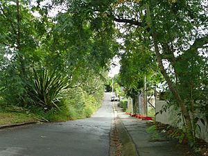
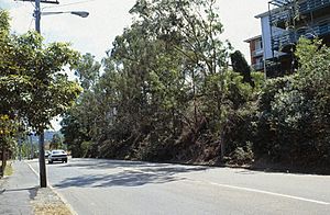
Ithaca Embankments, Fernberg Road near Government House, 2009
|
|
| Location | Kelvin Grove & Red Hill & Paddington, Brisbane, Queensland, Australia |
| Design period | 1914 - 1919 (World War I) |
| Built | c. 1917 - c. 1923 |
| Architect | Alexander Jolly |
| Official name: Ithaca Embankments, Embankment - corner Latrobe & Macgregor Tces, Embankment - Northam Avenue, Embankments - Fernberg Rd near Government House, Embankment - Musgrave Rd opp Upper Clifton Tce, Embankments - Waterworks Rd & Lintern St, Embankments - Windsor Rd, Prospect Tce & Victoria St, Embankments - Latrobe Tce opp Gladstone St, Embankment - Musgrave Rd opp Confederate St, Embankments - corner Macgregor & Rockbourne Tces | |
| Type | state heritage (landscape, built) |
| Designated | 2 March 1993 |
| Reference no. | 601209 |
| Significant period | c. 1917-c. 1923 (fabric) |
| Significant components | garden - bed/s, trees/plantings, wall/s - retaining, steps/stairway, pathway/walkway, fencing |
| Lua error in Module:Location_map at line 420: attempt to index field 'wikibase' (a nil value). | |
The Ithaca Embankments are a special group of landscaped areas in Brisbane, Australia. They are found in the suburbs of Kelvin Grove, Red Hill, and Paddington. These embankments were designed by a landscape gardener named Alexander Jolly. They were built between about 1917 and 1923. Today, they are protected as part of the Queensland Heritage Register because of their historical importance.
Contents
History of the Embankments
The first rock gardens and stone walls on these embankments were created around 1917. This was done for the Ithaca Town Council, which was like the local government for the area back then. More areas, like MacGregor Terrace and Waterworks Road, were landscaped in 1918. Fernberg Road and Northam Avenue followed in 1923.
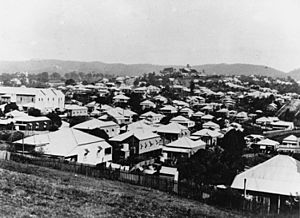
Around the early 1900s, the area of Ithaca grew very quickly. Many people moved there, partly because new tram lines made it easier to get around. Because of this growth, the Ithaca Town Council decided to make the town look nicer. They started many projects, like building Lang Park (a sports ground) and the Ithaca Swimming Pool in 1917. They also created the Ithaca Children's Playground in 1918.
Many streets in Ithaca were built on hilly land. This meant that when roads were cut, they often left steep slopes or "embankments." The Council found it was cheaper and prettier to plant gardens on these slopes instead of cutting them down. This idea was quite new for Brisbane at the time. Other councils mostly just planted trees or removed weeds.
The Ithaca Town Council's work was so good that other councils from Queensland and even other states asked for photos and plans. At a big town planning conference in 1918, Ithaca showed off how they turned "ugly cuttings" into beautiful street features.
A lot of this great work was thanks to the Council's landscape gardener, Alexander Jolly. He was a very keen gardener and had a lot of experience. Jolly was a self-taught man who changed the look of Ithaca between about 1915 and 1925. People loved his work, and even the Governor of Queensland, Sir Matthew Nathan, praised his "good taste."
Some of Jolly's most famous projects included the rock gardens along Musgrave and Waterworks Roads. He also worked on Cook's Hill and the Ithaca War Memorial garden. After he passed away, the war memorial garden was named Alexander Jolly Park in his honor. This was a special way to remember him and his hard work. While some of his projects have changed or disappeared, many of the rock gardens on the embankments still show his amazing work. They remind us how much the Ithaca Town Council cared about making their town beautiful.
What the Embankments Look Like
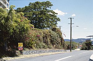
The Ithaca Town Council embankments all share a similar design and types of plants. They show off Alexander Jolly's unique style. One of the best preserved is the Windsor Road embankment in Kelvin Grove.
Windsor Road Embankment
This embankment is on Windsor Road in Kelvin Grove. It goes from Prospect Terrace to Victoria Street. It's covered in many plants, like different types of Agave (a spiky plant), Queen Palms, and Camphor laurel trees. You can also see colorful Bougainvillea and other small shrubs that were popular long ago.
The embankment has a concrete footpath next to it. There are also parts where the natural rock face shows through. Along Prospect Terrace and Windsor Road, there's a low wall made of three layers of schist stone. You can also see a newer blue stone wall at the corner of Prospect Terrace and Windsor Road.
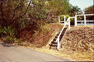
A set of concrete stairs is on the Windsor Road side. A sloping path with a wooden fence leads through the plants to one of the houses. This path has a low, three-layered stone wall made of porphyry.
Large trees grow along the front of the properties and hang over the embankment. These include Weeping Figs, Camphor laurels, and Mango trees. There's also an avenue of Queen Palms. All these trees, along with the embankment, create a special landmark that can be seen from nearby hills.
Musgrave Road Embankments
- Corner of Windsor & Musgrave Roads: This embankment is below the Red Hill Post Office. It has two trees, a concrete wall, and a wooden fence. The planted area includes agave plants, palms, and small shrubs. Across the road, there's a lower stone wall with a wooden fence. This area also has agave plants, trees, and grasses.
- Between Federal & Confederate Streets: This part of the Musgrave Road embankment has a very well-preserved stone wall. It shows different ways the walls were built. The embankment has a bitumen footpath and a wooden fence along the top. You'll find agave plants, palms, trees, and small shrubs here, along with areas of natural rock.
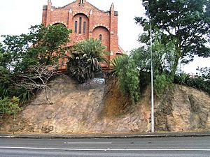
- Opposite Upper Clifton Terrace: This tall embankment is below St Brigid's Church. It has a retaining wall at the top, which forms the church's front area. At the bottom, there's a bitumen footpath. You can see rock faces, agave plants, trees, and grasses.
Waterworks Road Embankment
This embankment is on Waterworks Road, between Mornington and Lintern Streets. It has a wooden fence along the top and Waterworks Road at its base. There are large sections of rock face with agave plants, small shrubs, and grasses. You can also find a concrete stair at the street corner.
Fernberg Road Embankment
This embankment is on Fernberg Road in Paddington, near Kaye Street. It has parts of a stone wall on the lower side. You can see agave plants, trees, and small shrubs here. Across the road, in front of Government House, there's another embankment with different stone walls, agave plants, trees, palms, and a grassy footpath.
MacGregor Terrace Embankments
- From Tooth Avenue to Latrobe Terrace: This tall embankment is next to houses at the top and the road at the bottom. It has many plants, including agave, trees, shrubs, and vines. You can also see areas of rock face and parts of old stone walls.
- Corner of MacGregor & Rockbourne Terraces: This embankment has a stone wall that stands out on the street corner. It also has a bitumen footpath and areas of rock face along MacGregor Terrace. You'll find agave plants, trees, palms, and small shrubs here.
Northam Avenue Embankment
This long embankment is on Northam Avenue in Bardon. It goes from MacGregor Terrace for about half the length of Northam Avenue. It has a wooden fence along the top and a section of stone wall at the bottom. There's also a concrete stair towards the end. You can see agave plants, trees, palms, shrubs, and grasses.
Latrobe Terrace Embankment
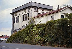
This embankment is on Latrobe Terrace in Paddington, leading to the Ithaca War Memorial. It's next to the War Memorial, the old Ithaca Fire Station, and the Paddington Tramways Substation. At the Memorial Park end, there's a stone wall with many agave plants. Another stone wall at the Enoggera Terrace end is a leftover from earlier gardens. The embankment has various agave plants, trees, palms, shrubs, vines, and grasses.
Why They Are Heritage Listed
The Ithaca Embankments were added to the Queensland Heritage Register on March 2, 1993. This means they are important to Queensland's history and are protected.
- Showing History: These embankments help us understand how the Town of Ithaca grew. They show how the Ithaca Town Council worked hard to make the town better for its residents in the early 1900s.
- Showing Design: They are great examples of the street beautification projects done by the Ithaca Town Council. They also show how stone walls and edges were built by public landscape gardeners in Brisbane a long time ago.
- Looking Good: People in the community value how beautiful these embankments are. They add a lot to the look of Brisbane's inner western suburbs.
- Special Connection: The embankments are also important because they are linked to the work of Alexander Jolly. He was the Ithaca Town Council's landscape gardener who transformed the town's appearance in the early 20th century.
 | James Van Der Zee |
 | Alma Thomas |
 | Ellis Wilson |
 | Margaret Taylor-Burroughs |


